El Niño and La Niña are two powerful climate patterns that originate in the Pacific Ocean but influence weather across the entire globe. These events are part of a larger system known as the El Niño–Southern Oscillation (ENSO), which shifts ocean temperatures and atmospheric conditions in cycles.
Understanding these phenomena helps explain unusual weather patterns such as droughts, heavy rainfall, heatwaves, and even changes in hurricane activity.
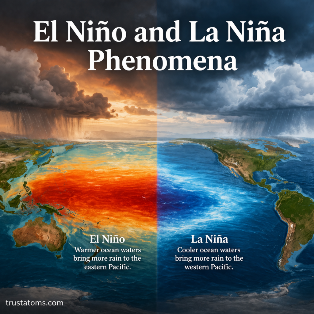
What Is El Niño?
El Niño is the warm phase of ENSO. It occurs when sea surface temperatures in the central and eastern Pacific Ocean become significantly warmer than average.
Key Characteristics of El Niño
- Warmer-than-normal ocean temperatures in the equatorial Pacific
- Weakened trade winds
- Reduced upwelling of cold, nutrient-rich water
- Shift in rainfall patterns toward the eastern Pacific
How El Niño Affects Weather
El Niño can dramatically alter global weather patterns:
- United States: Wetter conditions in the southern regions, milder winters in the north
- South America: Increased rainfall and flooding along the west coast
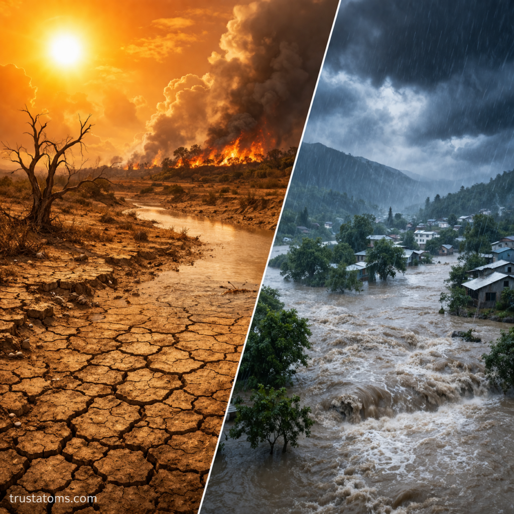
- Australia & Southeast Asia: Drier conditions and increased risk of wildfires
- Africa: Varies by region, but can lead to droughts in some areas
What Is La Niña?
La Niña is the cool phase of ENSO and is essentially the opposite of El Niño. It occurs when sea surface temperatures in the central and eastern Pacific are cooler than average.
Key Characteristics of La Niña
- Cooler-than-normal ocean temperatures in the equatorial Pacific
- Stronger-than-average trade winds
- Increased upwelling of cold water
- Enhanced rainfall in the western Pacific
How La Niña Affects Weather
La Niña also shifts global climate patterns:
- United States: Colder winters in the northern regions, drier conditions in the south
- Australia & Southeast Asia: Increased rainfall and potential flooding
- South America: Drier conditions along the west coast
- Atlantic Ocean: Increased hurricane activity
The Role of the Pacific Ocean
The Pacific Ocean plays a central role in both phenomena due to its size and influence on atmospheric circulation.
Normal Conditions (Neutral ENSO Phase)
Under typical conditions:
- Trade winds blow from east to west across the Pacific
- Warm water accumulates near Asia and Australia
- Cold water rises (upwelling) near South America
- Rainfall is concentrated in the western Pacific
What Changes During ENSO Events?
- El Niño: Trade winds weaken, warm water shifts eastward
- La Niña: Trade winds strengthen, pushing warm water further west
These shifts disrupt the balance between ocean and atmosphere, leading to widespread climate effects.
Why ENSO Matters
ENSO is one of the most important drivers of year-to-year climate variability on Earth.
Global Impacts
- Alters agricultural productivity
- Affects fisheries due to changes in nutrient availability
- Influences water supply and drought conditions
- Impacts ecosystems and biodiversity
Economic and Social Effects
- Crop failures or surpluses
- Increased disaster risks (floods, droughts, storms)
- Strain on infrastructure and resources
El Niño vs. La Niña: Key Differences
Temperature Patterns
- El Niño: Warmer ocean temperatures
- La Niña: Cooler ocean temperatures
Wind Behavior
- El Niño: Weakened trade winds
- La Niña: Strengthened trade winds
Rainfall Distribution
- El Niño: Shifts rainfall eastward
- La Niña: Concentrates rainfall in the western Pacific
Ocean Upwelling
- El Niño: Reduced upwelling
- La Niña: Increased upwelling
How Scientists Monitor ENSO
Scientists use a combination of tools to track and predict ENSO events:
Observation Methods
- Satellite measurements of sea surface temperature
- Ocean buoys across the Pacific
- Atmospheric pressure monitoring
- Climate models and simulations
Key Indicators
- Temperature anomalies in the Niño regions
- Changes in trade wind strength
- Southern Oscillation Index (SOI) values
These tools help forecast upcoming El Niño or La Niña events months in advance.
How Often Do El Niño and La Niña Occur?
ENSO events typically occur every 2 to 7 years, but their intensity and duration can vary.
Duration
- Most events last 9–12 months
- Some may persist for multiple years
Variability
- No two events are exactly alike
- Impacts depend on strength, timing, and regional factors
Climate Change and ENSO
Scientists are actively studying how climate change may influence ENSO patterns.
Possible Trends
- Increased intensity of extreme events
- More frequent shifts between El Niño and La Niña
- Greater variability in global weather patterns
While research is ongoing, it’s clear that ENSO will remain a key factor in understanding future climate behavior.
Final Thoughts
El Niño and La Niña are powerful natural processes that shape weather patterns across the globe. By influencing ocean temperatures, wind systems, and rainfall distribution, they impact everything from agriculture to natural disasters.
Understanding ENSO not only helps scientists predict weather changes but also allows societies to better prepare for its wide-ranging effects.