Earth’s most dramatic landscapes are found in geologically active regions—areas where tectonic plates interact, volcanoes erupt, and earthquakes reshape the land. These regions are constantly evolving, producing mountains, valleys, volcanoes, and other landforms at a much faster rate than stable areas.
Understanding landform development in active regions helps explain how Earth’s surface is built, reshaped, and transformed over time.
What Are Active Regions?
Active regions are areas of Earth where geological processes are currently shaping the landscape.
Key Characteristics
- Frequent earthquakes
- Volcanic activity
- Ongoing tectonic movement
- Rapid landform change
These regions are typically located along plate boundaries.
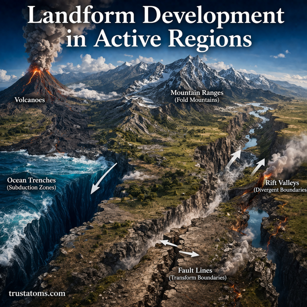
Types of Active Regions
Different types of plate boundaries create different landforms.
Convergent Boundaries
- Plates collide
- One plate may subduct beneath another
Landforms created:
- Mountain ranges
- Volcanic arcs
- Deep ocean trenches
Example: The Andes Mountains formed through subduction.
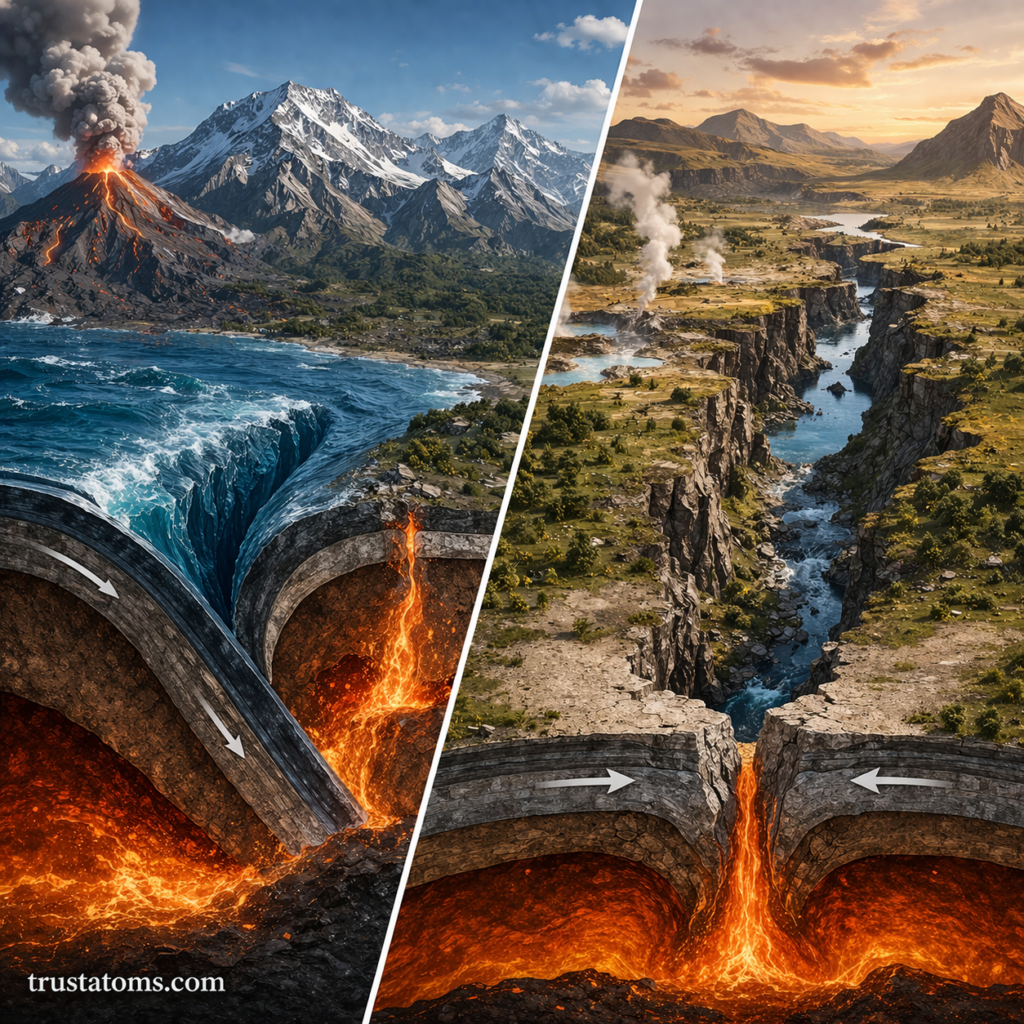
Divergent Boundaries
- Plates move apart
- Magma rises to fill the gap
Landforms created:
- Mid-ocean ridges
- Rift valleys
- Volcanic features
Example: The East African Rift is an active divergent boundary on land.
Transform Boundaries
- Plates slide past each other
Landforms created:
- Fault lines
- Offset land features
- Linear valleys
Example: The San Andreas Fault shapes much of California’s landscape.
How Landforms Develop in Active Regions
Landforms in active regions are shaped by a combination of powerful processes.
Tectonic Uplift
- Raises sections of Earth’s crust
- Creates mountains and plateaus
Volcanic Activity
- Builds new land through lava flows
- Forms volcanic cones and islands
Faulting and Folding
- Deforms rock layers
- Creates ridges, valleys, and fractures
The Role of Erosion in Active Regions
Even in highly active areas, erosion plays a crucial role.
Key Effects
- Wears down newly formed mountains
- Transports sediment to lower areas
- Shapes valleys and slopes
This creates a balance between landform creation and landform destruction.
Rapid vs Gradual Landform Change
Active regions experience both sudden and slow changes.
Rapid Changes
- Earthquakes can shift land instantly
- Volcanic eruptions can build new land in days
- Landslides reshape slopes quickly
Gradual Changes
- Mountain building over millions of years
- Slow uplift and erosion
- Sediment accumulation
Unique Landforms in Active Regions
Active regions produce some of the most recognizable landforms on Earth.
Volcanoes
- Form from rising magma
- Can create islands and mountain peaks
Rift Valleys
- Form where crust pulls apart
- Often contain lakes and volcanic features
Fold Mountains
- Created by compression
- Feature layered, folded rock structures
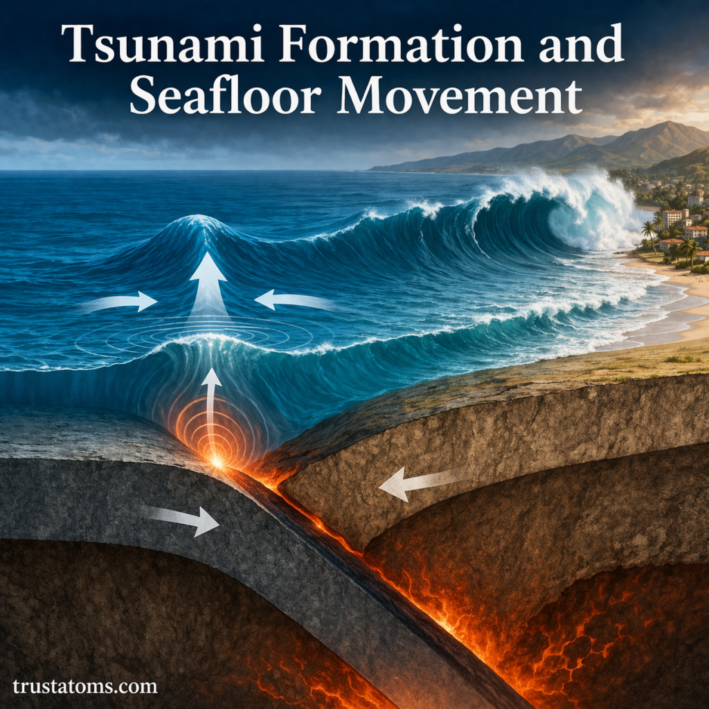
Hazards in Active Regions
The same processes that create landforms also pose risks.
Common Hazards
- Earthquakes
- Volcanic eruptions
- Tsunamis
- Landslides
These hazards can impact human populations living near active zones.
Benefits of Active Regions
Despite the risks, active regions offer important advantages.
Natural Resources
- Mineral deposits
- Geothermal energy
- Fertile volcanic soils
Scientific Value
- Provide insight into Earth’s internal processes
- Help scientists understand plate tectonics
Human Interaction with Active Landscapes
People often live in active regions due to the benefits they provide.
Examples of Human Use
- Farming on fertile volcanic soil
- Harnessing geothermal energy
- Mining valuable minerals
However, managing risk is essential in these areas.
Why Landform Development Matters
Studying landform development in active regions helps us:
- Predict natural hazards
- Plan safer cities and infrastructure
- Understand Earth’s geological history
- Manage natural resources responsibly
Final Thoughts
Active regions are some of the most dynamic and fascinating areas on Earth. They are constantly building and reshaping landforms through powerful geological forces.
By understanding how these regions work, we gain a deeper appreciation of Earth’s ever-changing surface—and the forces that continue to shape it.