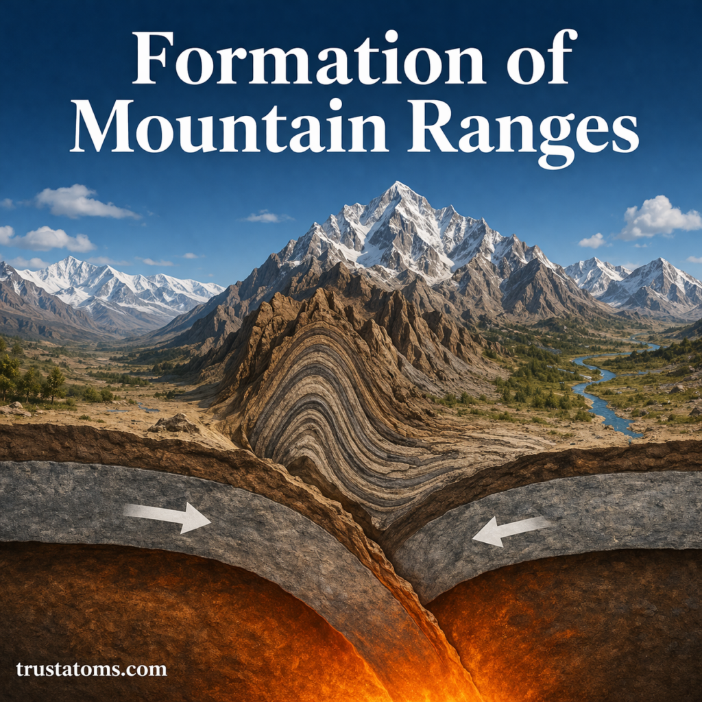
The Earth’s surface is constantly in motion, even though we don’t feel it. Massive sections of the crust, known as tectonic plates, move slowly over time—sometimes only a few centimeters per year.
Today, scientists can measure this movement with incredible precision using Global Positioning System (GPS) technology. This has revolutionized our understanding of plate tectonics, earthquakes, and Earth’s dynamic behavior.
What Is Plate Motion?
Plate motion refers to the movement of large sections of Earth’s lithosphere over the semi-fluid asthenosphere beneath it.
These tectonic plates:
- Carry continents and ocean basins
- Interact at boundaries (convergent, divergent, transform)
- Move at rates similar to fingernail growth (about 1–10 cm per year)
Tracking this motion is essential for understanding geological processes and hazards.
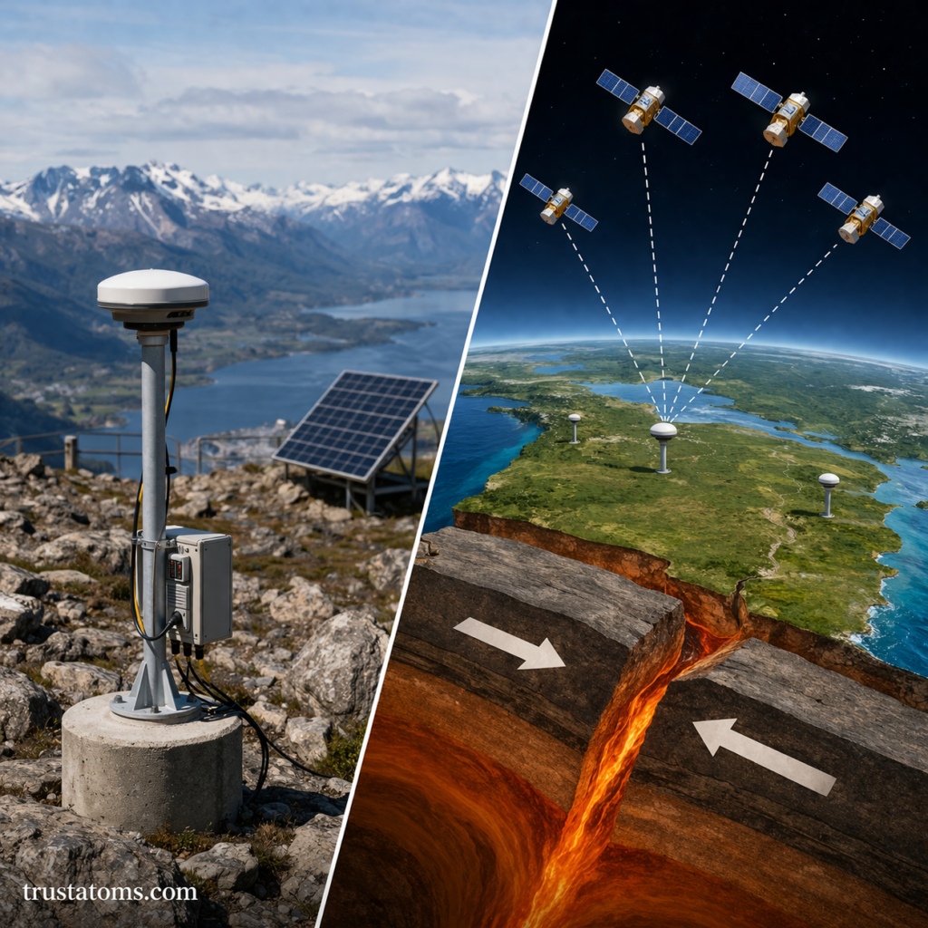
What Is GPS and How Does It Work?
The Global Positioning System (GPS) is a network of satellites orbiting Earth that transmit signals to receivers on the ground.
A GPS receiver determines its exact position by calculating the time it takes for signals from multiple satellites to arrive.
Key Components of GPS
- Satellites orbiting Earth
- Ground-based receivers
- Atomic clocks for precise timing
- Data processing systems
With this system, positions can be measured with accuracy down to millimeters when used for scientific purposes.
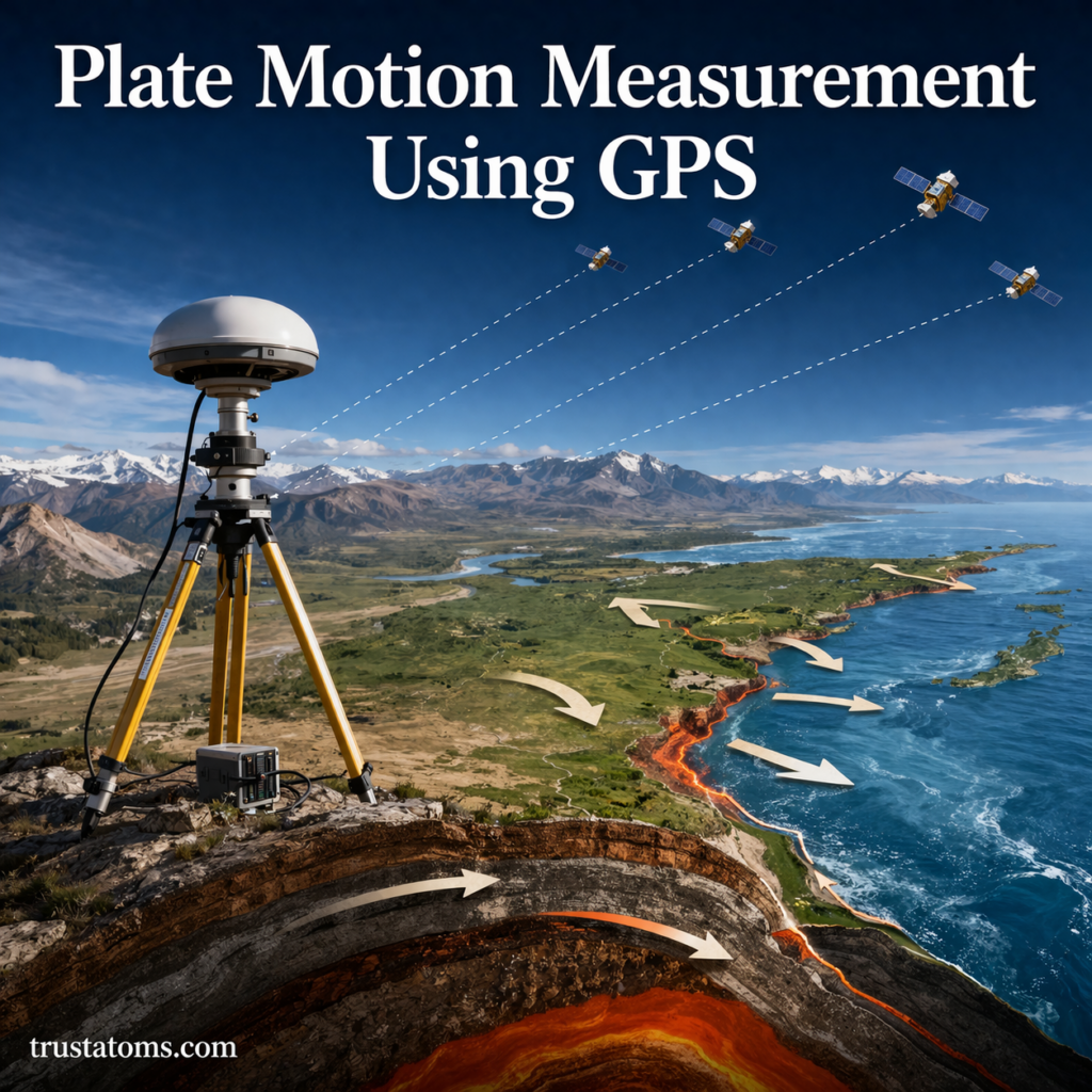
How GPS Measures Plate Motion
GPS allows scientists to track the exact position of points on Earth’s surface over time.
Step-by-Step Process
- A GPS station is installed on a tectonic plate
- The station records its precise position continuously
- Data is collected over months or years
- Small changes in position reveal plate movement
Even movements as small as a few millimeters per year can be detected.
Types of GPS Measurements in Geology
Different GPS techniques are used depending on the level of precision required.
Continuous GPS (cGPS)
- Stations operate 24/7
- Provide real-time data
- Ideal for monitoring active plate boundaries
Campaign GPS
- Measurements taken periodically (e.g., yearly)
- Useful in remote or less active regions
High-Precision GPS
- Uses advanced corrections to reduce errors
- Achieves millimeter-level accuracy
What GPS Reveals About Plate Tectonics
GPS data has transformed our understanding of how plates move and interact.
Plate Speed and Direction
- Scientists can measure how fast plates move
- Direction of movement is mapped precisely
Plate Boundary Behavior
- Identify zones of compression, extension, or sliding
- Detect strain buildup before earthquakes
Deformation of the Earth’s Crust
- Not all motion happens at plate boundaries
- GPS reveals subtle bending and stretching within plates
GPS and Earthquake Monitoring
One of the most important uses of GPS is in earthquake research.
Measuring Strain Accumulation
As tectonic plates push against each other, stress builds up in the crust.
GPS can detect:
- Gradual deformation of land
- Locked fault zones
- Areas at risk of future earthquakes
Detecting Sudden Movement
After an earthquake, GPS stations record:
- Rapid shifts in position
- Ground displacement
- Changes in plate motion patterns
This helps scientists understand how earthquakes release energy.
Real-World Applications of GPS Plate Measurements
GPS technology is widely used in both science and society.
Hazard Assessment
- Identify earthquake-prone regions
- Improve early warning systems
Infrastructure Planning
- Guide construction in tectonically active areas
- Reduce risk to buildings and roads
Scientific Research
- Test theories of plate tectonics
- Study long-term Earth processes
Advantages of Using GPS for Plate Motion
GPS has become the preferred tool for measuring plate movement due to its accuracy and reliability.
Key Benefits
- Extremely precise (millimeter-level accuracy)
- Continuous data collection
- Global coverage
- Real-time monitoring capabilities
Limitations and Challenges
Despite its advantages, GPS measurement is not without challenges.
Signal Interference
- Atmospheric conditions can affect accuracy
- Obstacles like buildings or mountains may block signals
Equipment Costs
- High-precision GPS systems can be expensive
Data Processing Complexity
- Requires advanced software and expertise
- Corrections must be applied for accurate results
The Future of Plate Motion Measurement
Advancements in technology continue to improve how we measure Earth’s movements.
Emerging Developments
- Integration with satellite radar (InSAR)
- Improved real-time monitoring systems
- Expanded global GPS networks
These innovations will provide even more detailed insights into tectonic activity.
Final Thoughts
Plate motion measurement using GPS has revolutionized Earth science. What was once estimated over millions of years can now be measured in real time with remarkable precision.
By tracking the slow movement of tectonic plates, scientists can better understand earthquakes, reduce risks, and gain deeper insight into the dynamic nature of our planet.