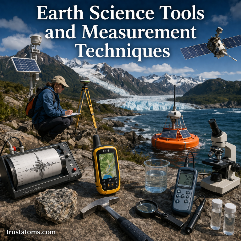
Earth science relies on a wide range of tools and measurement techniques to study our planet. From tracking earthquakes deep underground to analyzing atmospheric changes, scientists use specialized instruments to collect accurate data and better understand Earth’s systems.
These tools not only help researchers make discoveries but also play a critical role in predicting natural hazards and protecting communities.
What Are Earth Science Tools?
Earth science tools are instruments and technologies used to observe, measure, and analyze physical processes on Earth. They allow scientists to gather data about the atmosphere, oceans, land, and interior of the planet.
Main Areas of Measurement
- Geology (rocks, tectonics, earthquakes)
- Meteorology (weather and climate)
- Oceanography (oceans and currents)
- Environmental science (ecosystems and human impact)
Each field uses specific tools tailored to its focus.
Tools Used in Geology
Geologists study Earth’s structure, rocks, and tectonic activity.
Seismographs
- Measure ground vibrations caused by earthquakes
- Record seismic waves to determine earthquake location and magnitude
Rock Hammers and Hand Lenses
- Used for fieldwork to collect and examine rock samples
- Help identify minerals and textures
GPS (Global Positioning System)
- Tracks movement of tectonic plates
- Measures ground deformation over time
Tools Used in Meteorology
Meteorologists use instruments to monitor weather and atmospheric conditions.
Thermometers
- Measure temperature
- Essential for weather forecasting
Barometers
- Measure air pressure
- Help predict weather changes
Anemometers
- Measure wind speed
- Used in weather stations and storm tracking
Weather Satellites
- Capture images of clouds and storms from space
- Provide large-scale atmospheric data
Tools Used in Oceanography
Oceanographers study the oceans and their processes.
Sonar (Sound Navigation and Ranging)
- Maps the seafloor using sound waves
- Helps measure ocean depth
Buoys
- Floating devices that collect ocean data
- Measure temperature, wave height, and currents
Submersibles and ROVs
- Explore deep ocean environments
- Collect samples and capture images
Tools Used in Environmental Science
Environmental scientists monitor ecosystems and human impacts.
Remote Sensing Technology
- Uses satellites and drones to gather data
- Tracks deforestation, pollution, and climate change
Soil Testing Kits
- Analyze soil composition and nutrients
- Used in agriculture and land management
Water Quality Sensors
- Measure pH, oxygen levels, and contaminants
- Help monitor freshwater and marine systems
Measurement Techniques in Earth Science
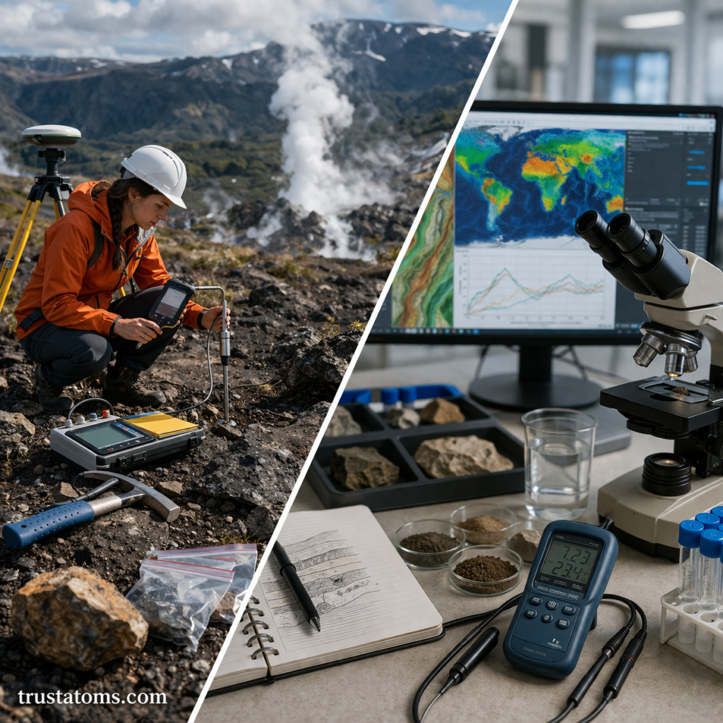
Beyond tools, scientists use specific techniques to interpret data.
Direct Measurement
- Involves collecting physical samples or readings
- Examples: rock samples, temperature readings
Indirect Measurement
- Uses waves or signals to infer properties
- Examples: seismic waves to study Earth’s interior
Modeling and Simulation
- Computer models predict future conditions
- Used in climate science and hazard forecasting
Data Analysis and Mapping
- Combines data into visual formats
- Often uses GIS (Geographic Information Systems)
How Technology Is Advancing Earth Science
Modern technology has transformed how scientists study Earth.
Key Advancements
- Satellites providing real-time global data
- Drones enabling access to remote areas
- AI and machine learning improving predictions
- High-resolution sensors increasing accuracy
These innovations allow faster and more precise data collection than ever before.
Importance of Accurate Measurements
Accurate data is essential for understanding Earth’s processes and making informed decisions.
Why It Matters
- Improves weather forecasting
- Helps predict natural disasters
- Supports environmental protection
- Guides resource management
Without reliable measurements, scientific conclusions would be less accurate and less useful.
Real-World Applications
Disaster Monitoring
- Seismographs detect earthquakes
- Satellites track hurricanes and wildfires
Climate Research
- Long-term data helps identify climate trends
- Supports global climate models
Urban Planning
- GIS data helps design safer cities
- Identifies risk zones for development
Common Misconceptions
“All Measurements Are Exact”
All tools have limitations and margins of error.
“Technology Replaces Fieldwork”
Field observations are still essential for accurate data collection.
“Only Scientists Use These Tools”
Many tools, like weather apps and GPS, are used in everyday life.
Key Takeaways
- Earth science tools measure and analyze Earth’s systems
- Different fields use specialized instruments
- Techniques include direct measurement, remote sensing, and modeling
- Technology continues to improve accuracy and efficiency
- These tools are essential for safety, research, and planning
Final Thoughts
Earth science tools and measurement techniques provide the foundation for understanding our planet. From the deepest ocean trenches to the highest layers of the atmosphere, these instruments allow scientists to observe processes that would otherwise remain hidden.
As technology continues to evolve, our ability to monitor, predict, and protect Earth will only improve—making these tools more important than ever.