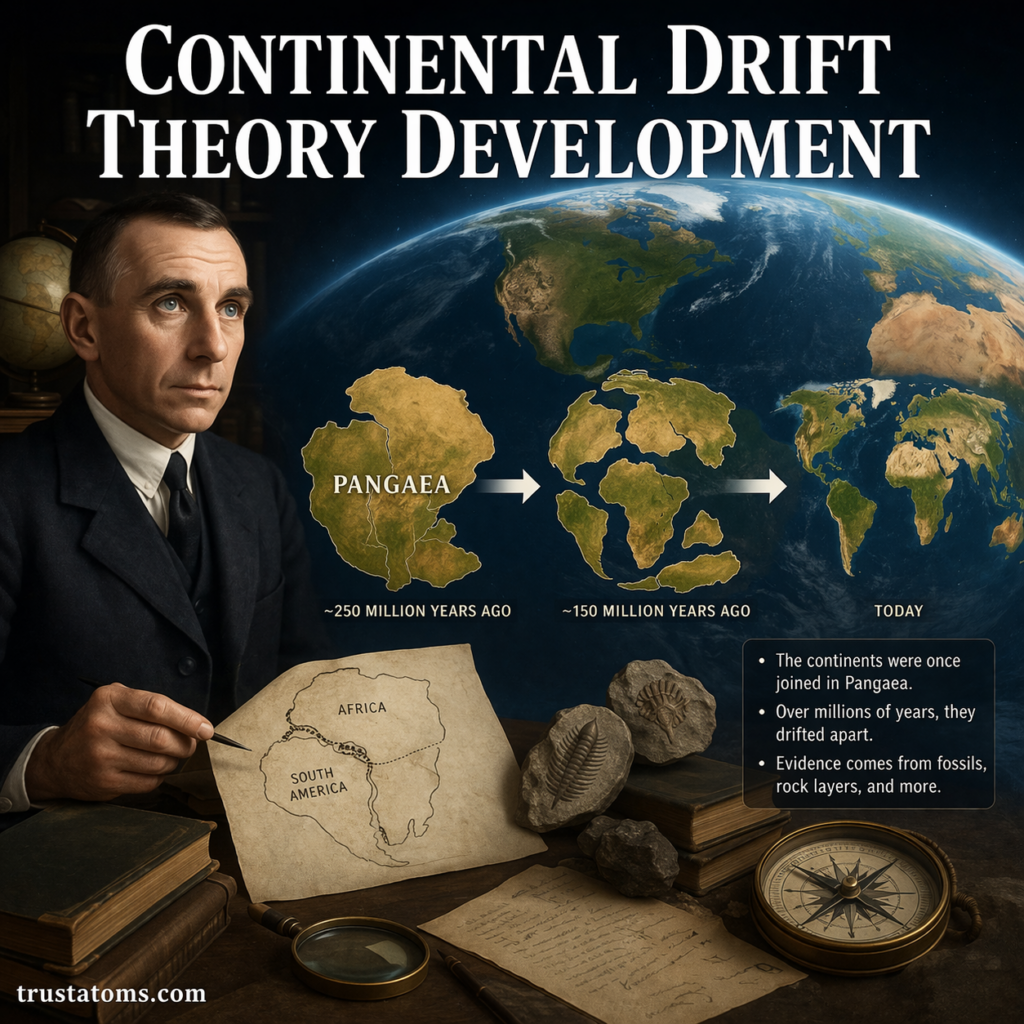
Continental drift theory developed from early observations that continents appeared to fit together, followed by Alfred Wegener’s 1912 hypothesis that they had moved across Earth’s surface. Fossil discoveries, matching rock formations, and later evidence from the ocean floor helped transform this controversial idea into the modern theory of plate tectonics.
The development of continental drift changed how scientists explain Earth’s geological history, mountain ranges, earthquakes, and the distribution of ancient organisms. It remains an important chapter in Earth science because it demonstrates how multiple independent observations can lead to a more complete scientific explanation.
What Is Continental Drift?
Continental drift is the idea that Earth’s continents have changed position relative to one another over geological time. The continents are not fixed features of the planet; they move as parts of Earth’s rigid outer plates.
Alfred Wegener suggested that all continents were once part of a supercontinent called Pangaea. According to geological reconstructions, this landmass later fragmented, and its continental pieces gradually moved apart.
Modern geology explains this movement through plate tectonics rather than continents independently pushing through stationary oceanic crust. One process that contributes to plate movement and the creation of oceanic lithosphere is examined in Seafloor Spreading Mechanisms.
Early Clues That Continents Had Once Been Connected
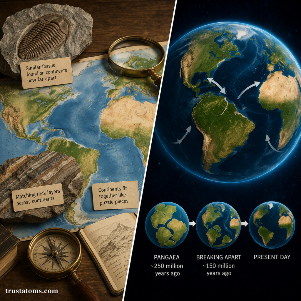
Long before scientists developed plate tectonics, they noticed similarities between landmasses separated by oceans. Several observations became especially significant when considered together.
The Matching Shapes of Continental Margins
The eastern outline of South America resembles the western outline of Africa. This resemblance had attracted attention for centuries, but modern reconstructions show a better match along the edges of continental shelves than along present-day coastlines, which continually change through erosion and deposition.
Identical Fossils on Separate Continents
Fossils of the freshwater reptile Mesosaurus have been found in both South America and southern Africa. According to paleontological evidence, this animal lived during the early Permian Period and was not adapted to crossing a vast saltwater ocean. Its distribution supports the interpretation that these regions were once connected.
Other examples include fossils of the seed fern Glossopteris across several southern continents. Scientists use such distributions alongside rock ages and geological structures to reconstruct former land connections.
Matching Rocks and Ancient Climate Evidence
Rock formations and mountain belts on different continents sometimes have corresponding ages, compositions, and structures. Geological evidence also includes ancient glacial deposits in regions that now experience warm climates. When southern continents are reconstructed into their former positions, these glacial patterns become easier to explain.
Alfred Wegener’s Continental Drift Hypothesis
In 1912, German scientist Alfred Wegener publicly presented his continental drift hypothesis. He developed the argument further in his 1915 book, The Origin of Continents and Oceans, bringing together geographical, geological, fossil, and paleoclimate evidence.
Wegener proposed that continents had once formed a connected landmass and subsequently separated. This challenged prevailing interpretations that treated continental positions as essentially permanent or explained matching fossils through former land bridges.
His proposal was notable because it attempted to explain several seemingly unrelated observations through one underlying idea: the movement of continents.
Why Scientists Initially Rejected Continental Drift
Although Wegener assembled substantial observational evidence, he could not identify a physically convincing mechanism capable of moving continents. His proposed forces, including those associated with Earth’s rotation and tidal effects, were inadequate to explain the motion.
Many geologists also questioned how continents could move through supposedly rigid oceanic crust. At the time, scientists lacked detailed maps of the deep ocean floor and the geophysical measurements needed to understand the behavior of Earth’s lithosphere.
Continental drift therefore remained controversial for decades. The central problem was not simply whether continents had moved, but how such movement could occur.
Ocean-Floor Discoveries Changed the Debate
During the mid-20th century, improved ocean mapping and geophysical surveys revealed extensive underwater mountain chains, deep trenches, and systematic patterns in oceanic crust. These discoveries provided new evidence for moving tectonic plates.
Seafloor Spreading at Ocean Ridges
Scientists discovered that new ocean crust forms at mid-ocean ridges and spreads outward. As tectonic plates separate, mantle material rises and partially melts, producing magma that cools to form new oceanic crust.
Geologist Harry Hess helped develop the seafloor-spreading hypothesis in the early 1960s. It offered a physical framework for understanding how the ocean floor changes as plates move.
Magnetic Stripes Recorded Seafloor Movement
As basalt cools, certain magnetic minerals preserve information about the direction of Earth’s magnetic field. Surveys revealed alternating bands of normal and reversed magnetic polarity arranged approximately symmetrically on opposite sides of spreading ridges.
In 1963, Frederick Vine and Drummond Matthews proposed an explanation connecting these magnetic patterns with seafloor spreading and geomagnetic reversals. Lawrence Morley independently developed a similar interpretation. The magnetic evidence strongly supported the creation and outward movement of oceanic crust.
From Continental Drift to Plate Tectonics
By the late 1960s, evidence from seafloor spreading, earthquakes, magnetic measurements, and ocean trenches helped establish plate tectonics as a comprehensive geological theory.
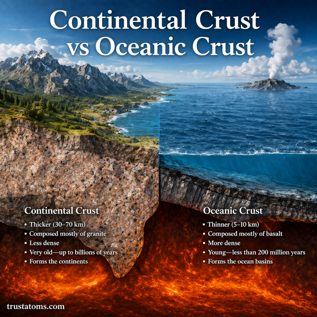
The distinction is that continental drift describes the changing positions of continents, while plate tectonics explains the movement and interactions of entire lithospheric plates. These plates contain continental crust, oceanic crust, or both, and move over the weaker underlying mantle.
Scientists now combine rock records, fossil distributions, magnetic data, and plate motions to reconstruct ancient geography, as described in Plate Reconstruction in Geological History.
The broader Theory of Plate Tectonics also explains the formation of many mountain belts, ocean basins, volcanic arcs, and major earthquake zones.
How Modern Measurements Confirm Continental Movement
Satellite-based geodesy, including GPS measurements, allows scientists to track plate movement directly. Many tectonic plates move at rates of a few centimeters per year, although speeds vary by location and plate.
For example, a plate moving at 3 centimeters per year would travel approximately 30 kilometers in one million years if its speed and direction remained constant. That is only a small annual movement, but over geological time it can substantially change the positions of continents and oceans.
Scientists also compare the ages of oceanic rocks, patterns of seismic activity, and magnetic records. Oceanic crust generally becomes older with increasing distance from spreading ridges, consistent with the movement predicted by plate tectonics.
How Continental Drift Changed Earth Science
The acceptance of continental movement gave scientists a unified framework for understanding processes previously studied separately. Mountain formation could be connected to plate convergence, while volcanic arcs and deep earthquakes could be explained through subduction.
Continental reconstructions also help researchers interpret ancient climate evidence, changing ocean connections, and the historical distribution of organisms. Geological records indicate that shifting landmasses have influenced ocean circulation and environmental conditions over long periods.
Plate tectonics remains useful for studying geological hazards, reconstructing sedimentary basins, and understanding how Earth’s surface continues to change.
Frequently Asked Questions
Who first proposed continental drift theory?
Alfred Wegener formally presented his continental drift hypothesis in 1912. Earlier thinkers had noticed similarities between continental coastlines, but Wegener developed a broader scientific argument using fossils, geological formations, and ancient climate evidence.
Is continental drift the same as plate tectonics?
No. Continental drift describes the movement of continents over geological time. Plate tectonics explains how rigid lithospheric plates move and interact, providing the wider framework for continental motion, seafloor spreading, subduction, and mountain building.
Are continents still moving today?
Yes. GPS and other geodetic measurements confirm that tectonic plates continue moving, commonly at rates of centimeters per year. These movements gradually alter continental positions and can generate earthquakes where stress accumulates along plate boundaries.
Continental drift theory developed through the gradual accumulation of evidence, from matching fossils and rocks to magnetic patterns on the ocean floor. Wegener identified the possibility of moving continents, but later discoveries explained their movement through plate tectonics. Modern measurements now confirm that the slow rearrangement of Earth’s surface continues today.
Sources: Wegener, The Origin of Continents and Oceans; U.S. Geological Survey, This Dynamic Earth: The Story of Plate Tectonics; Encyclopaedia Britannica, Continental Drift.