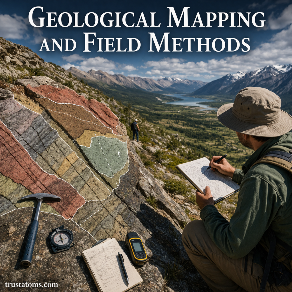
Geological mapping and field methods are essential tools used by Earth scientists to study the structure, composition, and history of the planet. By observing rocks, measuring features, and recording data directly in the field, geologists create maps that reveal how Earth’s surface is organized and how it has changed over time.
These methods form the foundation of geology, supporting everything from academic research to natural resource exploration and hazard assessment.
What Is Geological Mapping?
Geological mapping is the process of documenting and interpreting the distribution of rocks, structures, and geological features across an area.
A geological map typically shows:
- Different rock types and their locations
- Boundaries between rock units
- Faults, folds, and other structural features
- Surface and subsurface relationships
These maps provide a visual summary of Earth’s geology in a specific region.
Why Geological Mapping Is Important
Geological maps are used in a wide range of applications:
- Understanding Earth’s history and evolution
- Locating natural resources such as minerals, oil, and groundwater
- Identifying geological hazards like earthquakes and landslides
- Supporting engineering and construction projects
They are essential for both scientific research and practical decision-making.
Core Field Methods in Geology
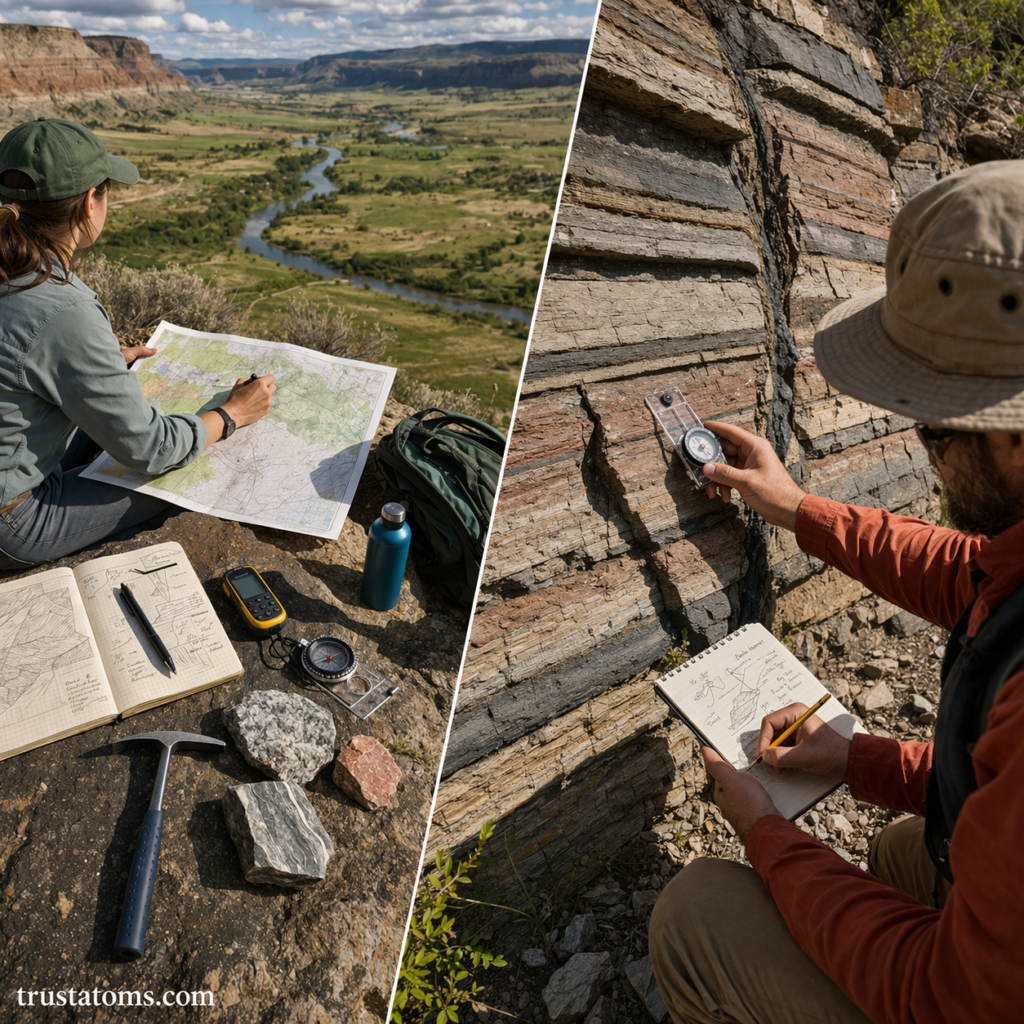
Field methods are the techniques geologists use to collect data directly from natural environments.
1. Rock Identification
Geologists examine rocks based on:
- Color and texture
- Mineral composition
- Grain size and structure
This helps determine the type and origin of the rock.
2. Measuring Orientation (Strike and Dip)
One of the most important field measurements involves the orientation of rock layers.
- Strike: The direction of a horizontal line on a rock layer
- Dip: The angle at which the layer slopes downward
These measurements help map how rock layers are tilted or folded.
3. Recording Field Notes
Accurate documentation is critical.
Geologists record:
- Observations of rock types and structures
- Sketches of outcrops and landscapes
- Coordinates and location data
- Interpretations and hypotheses
Field notebooks are often considered one of the most valuable tools in geology.
4. Sampling
Geologists collect rock, soil, or fossil samples for further analysis.
Samples are used to:
- Study mineral composition
- Determine age through dating methods
- Analyze chemical properties
5. Mapping Contacts and Boundaries
A key part of geological mapping is identifying where one rock type transitions into another.
These boundaries, known as contacts, may indicate:
- Changes in depositional environments
- Tectonic activity
- Intrusions of molten rock
Tools Used in Geological Fieldwork
Geologists rely on a combination of traditional and modern tools.
Essential Field Tools
- Rock hammer for breaking samples
- Hand lens for close examination
- Compass-clinometer for measuring strike and dip
- Field notebook and pencils
- Topographic maps
Modern Technologies
Advancements have improved accuracy and efficiency:
- GPS devices for precise location tracking
- Geographic Information Systems (GIS) for digital mapping
- Drones for aerial surveys
- Remote sensing and satellite imagery
These tools complement traditional fieldwork rather than replace it.
Creating a Geological Map
Geological mapping involves several key steps:
Step-by-Step Process
- Pre-field research
- Study existing maps and data
- Identify key areas of interest
- Field data collection
- Observe and record geological features
- Measure orientations and collect samples
- Data organization
- Compile field notes and measurements
- Analyze patterns and relationships
- Map construction
- Draw rock units and boundaries
- Add symbols for structures like faults and folds
- Interpretation
- Develop a geological history of the area
Understanding Geological Structures in the Field
Geologists look for structures that reveal how rocks have been deformed.
Common Structures
- Faults – Breaks where rocks have moved
- Folds – Bends in rock layers
- Joints – Cracks without movement
These features help reconstruct tectonic forces and past events.
Challenges in Field Mapping
Fieldwork can be complex and unpredictable.
Common Challenges
- Limited exposure due to vegetation or soil cover
- Weather conditions affecting access and visibility
- Difficult terrain
- Incomplete or eroded rock records
Geologists must adapt and use multiple lines of evidence to interpret the landscape.
Geological Mapping and the Bigger Picture
Geological mapping connects directly to broader Earth science concepts, including Plate Tectonics and the Rock Cycle.
By mapping rocks and structures, scientists can:
- Track movement of tectonic plates
- Understand how rocks form and transform
- Reconstruct ancient environments and climates
Real-World Applications
Geological mapping plays a critical role in many industries:
- Energy – Locating oil, gas, and geothermal resources
- Mining – Identifying mineral deposits
- Environmental science – Assessing contamination and groundwater flow
- Engineering – Evaluating land stability for construction
It is also essential for disaster preparedness and land-use planning.
Final Thoughts
Geological mapping and field methods provide a direct way to study Earth by observing it in its natural setting. From identifying rock types to interpreting large-scale structures, these techniques allow scientists to piece together the planet’s history and understand its ongoing processes.
Even with modern technology, fieldwork remains at the heart of geology—where observation, measurement, and interpretation come together to reveal the story of Earth.