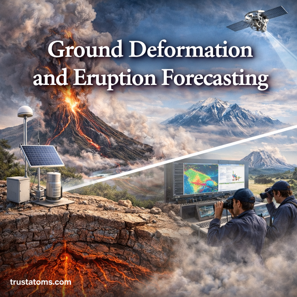
Volcanoes rarely erupt without warning. One of the most important clues scientists monitor is ground deformation—subtle changes in the shape of the Earth’s surface caused by moving magma beneath a volcano.
By studying these changes, researchers can better understand what is happening underground and improve eruption forecasting, helping to protect lives and infrastructure.
What Is Ground Deformation?
Ground deformation refers to the movement or distortion of Earth’s surface. Around volcanoes, this movement is usually caused by magma rising, accumulating, or shifting beneath the ground.
Common types of deformation include:
- Uplift (ground rising)
- Subsidence (ground sinking)
- Horizontal movement (sideways shifting)
Even small changes—sometimes just a few millimeters—can provide critical information.
What Causes Ground Deformation?
Ground deformation is primarily driven by processes occurring beneath a volcano.
1. Magma Movement
- Magma rising toward the surface pushes the ground upward
- Accumulation in magma chambers increases pressure
- Movement through cracks and fractures causes shifting
2. Gas Pressure
- Volcanic gases expand within magma
- Increased pressure can deform surrounding rock
3. Tectonic Activity
- Movement of tectonic plates can alter volcanic systems
- Can either increase or decrease volcanic pressure
4. Hydrothermal Systems
- Hot water and steam underground can change pressure conditions
- May contribute to surface deformation
Types of Ground Deformation
Scientists observe different deformation patterns depending on volcanic activity.
Inflation
- Ground swells upward
- Indicates magma is accumulating below
- Often a sign of increasing eruption potential
Deflation
- Ground sinks or collapses slightly
- Suggests magma is moving away or being released
Tilt Changes
- Ground tilts as pressure shifts
- Helps identify the direction of magma movement
Cracking and Fracturing
- Surface cracks form as pressure builds
- Can signal weakening of the زمین crust
How Ground Deformation Is Measured
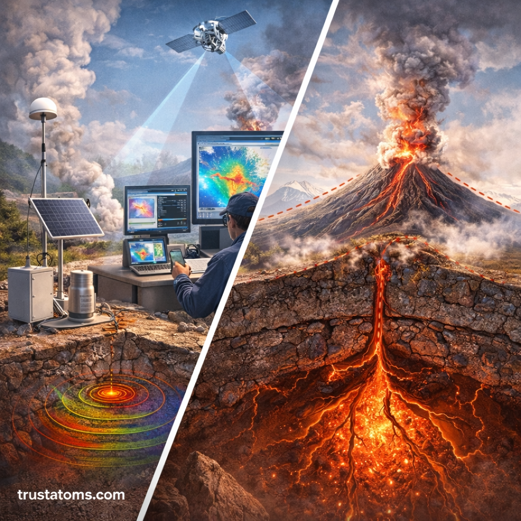
Modern technology allows scientists to measure ground deformation with high precision.
GPS (Global Positioning System)
- Tracks movement of specific points on the ground
- Measures changes down to millimeters
InSAR (Satellite Radar)
- Uses radar images from satellites
- Detects surface changes over large areas
Tiltmeters
- Measure very small changes in slope
- Useful for detecting magma movement
Laser and Drone Mapping
- Provides detailed surface models
- Tracks changes over time
How Ground Deformation Helps Forecast Eruptions
Ground deformation is a key tool in predicting volcanic eruptions.
Identifying Rising Magma
- Inflation signals magma buildup
- Rapid changes increase concern
Tracking Pressure Changes
- Sudden shifts may indicate imminent eruption
- Combined with gas emissions and seismic activity
Monitoring Trends Over Time
- Long-term patterns help assess volcanic behavior
- Not all deformation leads to eruptions
Scientists combine deformation data with other indicators to improve accuracy.
Limitations of Eruption Forecasting
While ground deformation provides valuable insights, forecasting eruptions is still challenging.
- Not all deformation results in an eruption
- Some eruptions occur with minimal warning
- Complex underground systems are difficult to model
- Data interpretation requires expertise
Forecasts are often probabilistic rather than exact predictions.
Real-World Examples
Ground deformation has played a critical role in monitoring active volcanoes worldwide:
- Detecting magma buildup before eruptions
- Helping authorities issue evacuation warnings
- Tracking post-eruption recovery and changes
These examples highlight the importance of continuous monitoring.
How Scientists Combine Multiple Warning Signs
Ground deformation is most effective when used alongside other monitoring methods:
- Seismic activity (earthquakes)
- Gas emissions (changes in composition and volume)
- Thermal imaging (heat changes)
- Visual observations (steam, ash, or lava)
Combining these signals provides a more complete picture of volcanic activity.
Key Takeaways
- Ground deformation is the movement of Earth’s surface caused by underground activity
- Magma movement is the primary driver near volcanoes
- Inflation and deflation are key indicators of pressure changes
- Advanced tools like GPS and satellite radar track deformation
- Forecasting eruptions relies on multiple data sources
Final Thoughts
Ground deformation offers a powerful window into the hidden processes beneath volcanoes. While it cannot guarantee precise predictions, it significantly improves our ability to anticipate eruptions and respond effectively.
As technology advances, scientists continue to refine eruption forecasting methods, helping communities live more safely alongside one of Earth’s most dynamic natural systems.