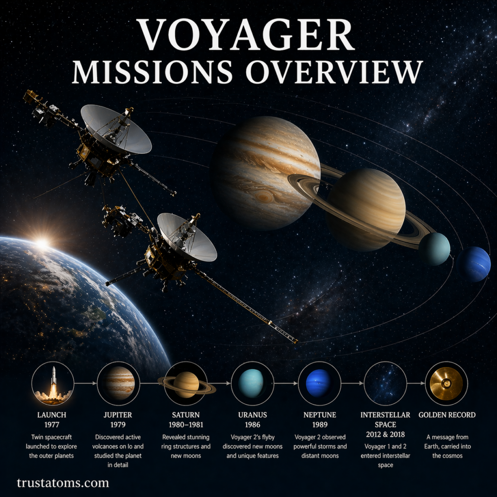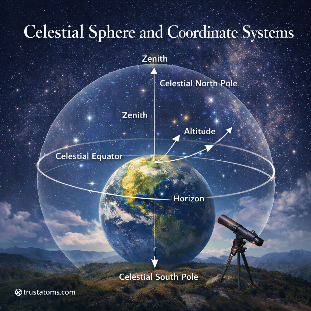
Understanding how astronomers map the sky starts with a simple but powerful concept: the celestial sphere. Even though space is vast and three-dimensional, we often use simplified systems to locate stars, planets, and other objects precisely.
This guide breaks down the celestial sphere and the coordinate systems used in astronomy so you can clearly understand how we “navigate” the sky.
What Is the Celestial Sphere?
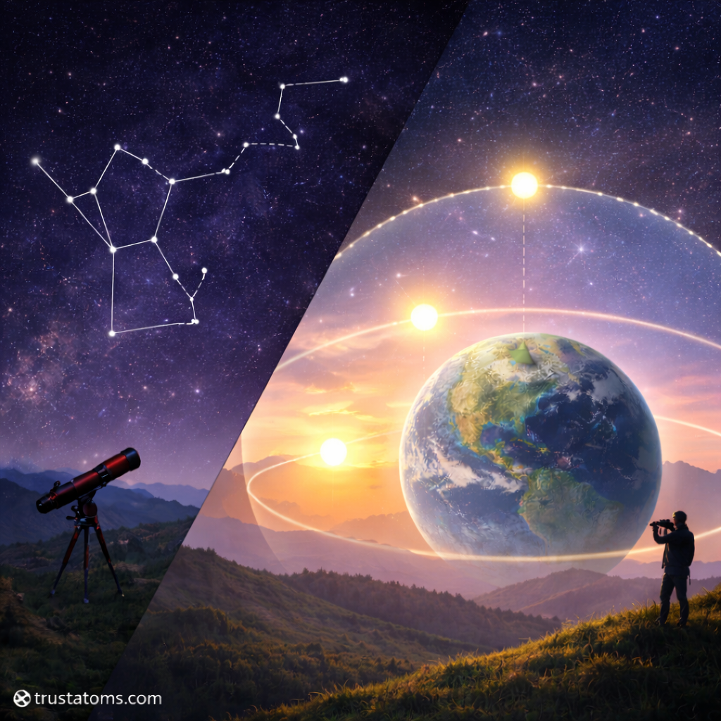
The celestial sphere is an imaginary sphere that surrounds Earth. All objects in the sky—stars, planets, the Sun, and the Moon—are projected onto this sphere.
Key idea:
- Earth sits at the center of the sphere
- The sphere itself is not real—it’s a visualization tool
- It helps us describe positions of objects in the sky
Even though stars are at vastly different distances, they appear as if they’re fixed on this sphere from our perspective.
Why Astronomers Use the Celestial Sphere
The universe is complex, but the celestial sphere simplifies observation and measurement.
Benefits:
- Makes it easier to track object positions
- Provides a consistent reference system
- Helps with navigation and telescope alignment
- Allows astronomers worldwide to share coordinates
Without this model, describing where something is in the sky would be much more difficult.
Key Features of the Celestial Sphere
To understand coordinate systems, you first need to know the main reference points on the celestial sphere.
Celestial Poles
- Extensions of Earth’s North and South Poles into space
- Stars appear to rotate around these points
Celestial Equator
- Projection of Earth’s equator onto the sky
- Divides the celestial sphere into northern and southern halves
Zenith and Nadir
- Zenith: the point directly above you
- Nadir: the point directly below you
Horizon
- The boundary between Earth and sky from your viewpoint
What Are Celestial Coordinate Systems?
Celestial coordinate systems are frameworks used to locate objects in the sky, similar to latitude and longitude on Earth.
They use angles and reference points to define positions precisely.
The Two Main Coordinate Systems
1. Horizon Coordinate System
This system is based on your location on Earth and changes depending on where you are.
Key Components:
- Altitude (Alt): How high an object is above the horizon (0° to 90°)
- Azimuth (Az): Direction along the horizon (0° to 360°)
Example:
- A star directly overhead has an altitude of 90°
- North = 0° azimuth, East = 90°, South = 180°, West = 270°
Pros:
- Easy to understand
- Useful for casual stargazing
Cons:
- Changes with time and location
- Not fixed for global reference
2. Equatorial Coordinate System
This is the most widely used system in astronomy because it is fixed relative to the stars.
Key Components:
- Right Ascension (RA): Similar to longitude, measured in hours (0–24)
- Declination (Dec): Similar to latitude, measured in degrees (-90° to +90°)
Reference Points:
- Based on the celestial equator
- Uses the vernal equinox as the zero point for RA
Pros:
- Universal and consistent
- Does not depend on observer location
Cons:
- Slightly harder to learn initially
Comparing the Two Systems
Horizon System
- Based on observer’s position
- Changes constantly
- Best for real-time viewing
Equatorial System
- Based on Earth’s axis
- Fixed relative to stars
- Best for astronomy and research
How Coordinate Systems Work Together
Astronomers often convert between coordinate systems depending on their needs.
Common uses:
- Telescope alignment uses equatorial coordinates
- Stargazing apps convert to horizon coordinates for your location
- Space observations rely heavily on equatorial coordinates
This flexibility allows both beginners and professionals to navigate the sky efficiently.
Real-World Applications
Understanding celestial coordinates isn’t just theoretical—it has practical uses.
Navigation
- Historically used by sailors for ocean travel
- Still relevant in some navigation systems
Astronomy
- Helps locate stars, planets, and galaxies
- Essential for telescope tracking
Space Exploration
- Used to guide spacecraft and satellites
- Critical for mission planning
Common Mistakes Beginners Make
When learning celestial coordinates, watch out for these pitfalls:
- Confusing altitude with declination
- Assuming all systems are fixed
- Ignoring the role of Earth’s rotation
- Forgetting that horizon coordinates change constantly
Understanding these differences will make learning much smoother.
Final Thoughts
The celestial sphere and coordinate systems are foundational tools in astronomy. While the sky may seem overwhelming at first, these systems bring structure and clarity.
Once you grasp the basics:
- You can identify objects more easily
- You can use telescopes more effectively
- You gain a deeper appreciation of how astronomers study the universe
It’s a simple model—but it unlocks a powerful way to understand the cosmos.