For thousands of years, humans have looked to the stars for direction. Long before GPS and modern maps, travelers used the night sky to find their way across oceans, deserts, and continents.
At the heart of this practice are star charts and the science of celestial navigation—tools and techniques that turn the sky into a reliable guide.
What Are Star Charts?
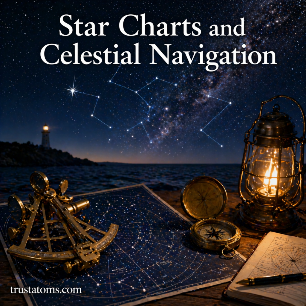
Star charts (also called star maps) are diagrams that show the positions of stars, constellations, and other celestial objects as seen from Earth.
What They Include
- Constellations and their patterns
- Bright stars and their relative positions
- Celestial coordinates (like latitude and longitude in the sky)
- The horizon and direction markers (north, south, east, west)
Star charts are designed for specific dates, times, and locations because the night sky changes throughout the year.
Understanding the Celestial Sphere
To use star charts effectively, it helps to understand the concept of the celestial sphere.
Key Ideas
- The sky is imagined as a giant sphere surrounding Earth
- Stars are mapped onto this sphere
- Positions are measured using coordinates
Important Reference Points
- Celestial equator: Projection of Earth’s equator into space
- Celestial poles: Points directly above Earth’s North and South Poles
- Zenith: The point directly overhead
This system allows astronomers and navigators to locate objects precisely in the sky.
What Is Celestial Navigation?
Celestial navigation is the practice of determining your position on Earth by observing celestial objects such as stars, the Sun, and the Moon.
It has been used by:
- Ancient sailors
- Explorers crossing oceans
- Pilots in early aviation
- Modern navigators as a backup method
How Celestial Navigation Works

Celestial navigation relies on measuring the angle between a celestial object and the horizon.
Basic Steps
- Identify a known star or celestial object
- Measure its angle above the horizon using a tool like a sextant
- Record the exact time of observation
- Compare measurements with reference tables
- Calculate your position (latitude and longitude)
This process allows navigators to pinpoint their location with surprising accuracy.
The Role of Polaris (The North Star)
One of the most important stars in navigation is Polaris, also known as the North Star.
Why Polaris Is Special
- It is located almost directly above Earth’s North Pole
- It appears nearly stationary in the sky
- Its height above the horizon corresponds to your latitude
For example:
- If Polaris is 30° above the horizon, you are at approximately 30° north latitude
This makes Polaris a simple and reliable guide in the Northern Hemisphere.
Constellations as Navigation Tools
Constellations act as visual landmarks in the sky.
Common Navigation Constellations
- Ursa Major (Big Dipper): Helps locate Polaris
- Orion: Visible in many parts of the world
- Cassiopeia: Useful for finding the North Star when the Big Dipper is not visible
By recognizing these patterns, navigators can orient themselves and find key stars.
Types of Star Charts
Different types of star charts serve different purposes.
Planispheres
- Rotating star charts
- Adjustable for date and time
- Ideal for beginners
Celestial Atlases
- Detailed maps of the sky
- Used by astronomers and advanced users
Digital Star Charts
- Apps and software for real-time sky mapping
- Use GPS to show exact sky positions
- Easy to use for modern stargazing
Tools Used in Celestial Navigation
While star charts are essential, navigators also rely on specialized tools.
Key Instruments
- Sextant: Measures the angle between objects and the horizon
- Chronometer: Keeps precise time
- Nautical almanac: Provides positions of celestial objects
- Compass: Helps determine direction
Together, these tools allow for accurate navigation even without modern technology.
Advantages of Celestial Navigation
Despite modern GPS systems, celestial navigation still has value.
Benefits
- Works without electricity or satellites
- Reliable in remote areas
- Provides a deeper understanding of the sky
- Serves as a backup navigation method
It remains an essential skill in maritime and aviation training.
Challenges and Limitations
Celestial navigation is powerful but not without difficulties.
Common Challenges
- Requires clear skies
- Needs precise timing and measurements
- Takes practice to master
- Light pollution can obscure stars
Despite these challenges, it remains a valuable and rewarding skill.
Star Charts in Modern Astronomy
Today, star charts are used for more than navigation.
Modern Uses
- Planning telescope observations
- Identifying stars and planets
- Learning constellations
- Supporting astrophotography
Digital tools have made star charts more accessible than ever.
Why Star Charts and Navigation Still Matter
Understanding star charts and celestial navigation connects us to both science and history.
They help us:
- Appreciate ancient navigation techniques
- Understand Earth’s position in space
- Develop observational skills
- Explore the night sky with confidence
Even in a world of advanced technology, the stars remain a timeless guide.
Final Thoughts
Star charts and celestial navigation transform the night sky into a map. By learning how to read the stars, you gain a skill that has guided explorers for centuries.
Whether you’re navigating the ocean or simply stargazing, these tools offer a deeper connection to the universe—and a reminder that the answers to direction have always been above us.