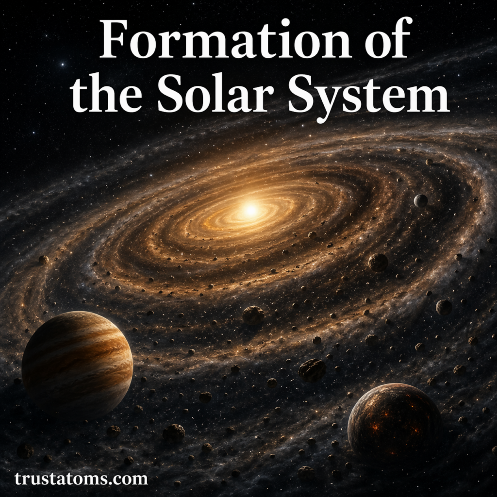
Seafloor Spreading Mechanisms

Illustration of seafloor spreading at a mid-ocean ridge with magma rising and tectonic plates moving apart.
Illustration of seafloor spreading showing magma upwelling and new oceanic crust formation at a mid-ocean ridge. trustatoms.com.

Seafloor spreading is one of the most important processes shaping Earth’s surface. It explains how new oceanic crust is created, how continents move, and how oceans expand over time.

First proposed in the mid-20th century, seafloor spreading became a key piece of evidence supporting plate tectonics. Today, it helps scientists understand everything from ocean formation to earthquakes and volcanic activity beneath the sea.

Continue reading “Seafloor Spreading Mechanisms”

Rift Valleys and Continental Separation

Illustration of a rift valley forming as continental plates pull apart with visible fault lines and rising magma.
Illustration of rift valley formation and continental separation driven by tectonic plate divergence. trustatoms.com.

Rift valleys are some of the most striking geological features on Earth, marking places where continents are slowly pulling apart. These विशाल depressions in Earth’s crust provide a rare glimpse into the dynamic forces shaping our planet from within.

From the famous East African Rift to ancient rift systems hidden beneath oceans, these formations reveal how continents break, oceans form, and Earth continues to evolve over millions of years.

Continue reading “Rift Valleys and Continental Separation”

Volcanic Arcs and Island Chains

Illustration of volcanic arcs and island chains forming along a subduction zone with active volcanoes in the ocean.
Illustration of volcanic arcs and island chains formed by tectonic plate subduction. trustatoms.com.

Volcanic arcs and island chains are some of the most fascinating features on Earth’s surface. Stretching across oceans and continents, these formations reveal powerful tectonic processes happening deep beneath our feet.

From the curved line of the Aleutian Islands to the explosive volcanoes of Japan, volcanic arcs and island chains are closely tied to plate boundaries and the movement of Earth’s crust.

Continue reading “Volcanic Arcs and Island Chains”

Formation of Mountain Ranges

Illustration showing the formation of mountain ranges through tectonic plate collision and folding of Earth’s crust.
Illustration of how mountain ranges form through tectonic plate movement. trustatoms.com.

Mountain ranges are among the most dramatic features on Earth’s surface, shaping landscapes, influencing climate, and supporting diverse ecosystems. From towering peaks like the Himalayas to ancient, weathered ranges like the Appalachians, mountains tell the story of powerful geological forces at work over millions of years.

Understanding how mountain ranges form helps explain not only Earth’s past but also the ongoing processes that continue to reshape our planet today.

Continue reading “Formation of Mountain Ranges”

Transform, Convergent, and Divergent Boundaries

Diagram showing transform, convergent, and divergent plate boundaries with arrows indicating plate movement and magma activity.
Illustration comparing the three main types of plate boundaries and how tectonic plates interact. trustatoms.com

Tectonic plate boundaries are where Earth’s most powerful geological activity occurs. These boundaries define how plates interact—whether they collide, move apart, or slide past each other.

The three main types of plate boundaries are transform, convergent, and divergent. Each plays a unique role in shaping Earth’s surface and driving natural events like earthquakes, volcanoes, and mountain formation.

Continue reading “Transform, Convergent, and Divergent Boundaries”

Theory of Plate Tectonics Explained

Diagram illustrating plate tectonics with divergent, convergent, and transform boundaries and magma movement beneath Earth’s surface.
Illustration of plate tectonics showing how Earth’s plates move and interact at different boundaries. trustatoms.com

The theory of plate tectonics is one of the most important concepts in Earth science. It explains how Earth’s outer layer is divided into moving plates and how their interactions shape the planet’s surface.

From earthquakes and volcanoes to mountain formation and ocean basins, plate tectonics helps us understand many of the dynamic processes that occur on Earth.

Continue reading “Theory of Plate Tectonics Explained”

Earth Science Tools and Measurement Techniques

Illustration of Earth science tools including seismograph, GPS device, weather instruments, and ocean buoy in a natural landscape setting.
Collection of Earth science tools used to measure and study the planet’s systems. trustatoms.com

Earth science relies on a wide range of tools and measurement techniques to study our planet. From tracking earthquakes deep underground to analyzing atmospheric changes, scientists use specialized instruments to collect accurate data and better understand Earth’s systems.

These tools not only help researchers make discoveries but also play a critical role in predicting natural hazards and protecting communities.

Continue reading “Earth Science Tools and Measurement Techniques”

Geological Hazards and Risk Mapping

Illustration showing geological hazards like earthquakes, landslides, volcanoes, and tsunami with a digital risk map displaying danger zones.
Visual overview of geological hazards and how risk mapping identifies high-risk areas. trustatoms.com

Geological hazards are natural events caused by Earth’s dynamic processes that can threaten lives, infrastructure, and the environment. From earthquakes and volcanic eruptions to landslides and tsunamis, these hazards can have devastating impacts if communities are unprepared.

Risk mapping plays a critical role in identifying vulnerable areas, helping governments, planners, and individuals make informed decisions to reduce damage and improve safety.

Continue reading “Geological Hazards and Risk Mapping”

Continental Crust vs Oceanic Crust

Side-by-side diagram comparing continental crust and oceanic crust showing differences in thickness, composition, and structure.
Comparison illustration of continental crust and oceanic crust highlighting key geological differences. trustatoms.com

Earth’s outermost layer, the crust, is not uniform. It is divided into two main types: continental crust and oceanic crust. While both are part of the lithosphere, they differ in composition, thickness, density, and age.

Understanding these differences helps explain how continents form, why oceans exist where they do, and how tectonic activity shapes the planet.

Continue reading “Continental Crust vs Oceanic Crust”

Mid-Ocean Ridges and Seafloor Spreading

Mid-ocean ridge diagram showing seafloor spreading with magma rising and oceanic plates moving apart.
Illustration of mid-ocean ridges and seafloor spreading showing how new oceanic crust forms. trustatoms.com

Mid-ocean ridges and seafloor spreading are key processes that shape Earth’s surface beneath the oceans. These underwater mountain chains mark places where new oceanic crust is continuously created, helping drive the movement of tectonic plates.

Understanding how these systems work provides insight into plate tectonics, ocean basin formation, and even the evolution of continents.

Continue reading “Mid-Ocean Ridges and Seafloor Spreading”