Erosion and Deposition in Landscapes

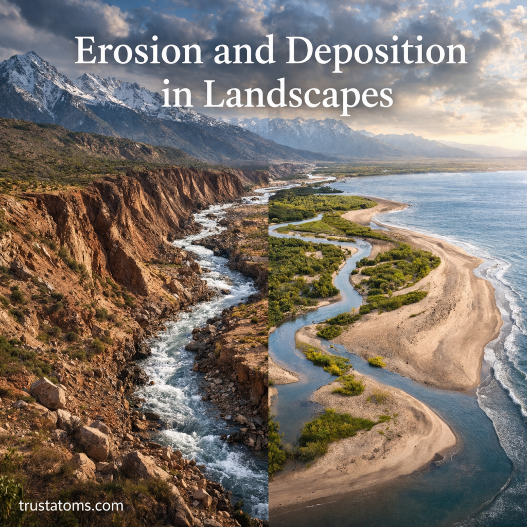
Illustration showing erosion and deposition in landscapes with river carving cliffs and forming sandbars and floodplains.
Flowing water erodes rock and soil from one location and deposits transported sediment in features such as sandbars and floodplains.

Erosion and deposition reshape landscapes by removing rock and soil from one location, transporting the material, and accumulating it somewhere else. Erosion moves sediment through water, wind, ice, or gravity, while deposition occurs when that transported material settles and builds new landforms.

These connected processes explain how rivers carve valleys, glaciers reshape mountains, and sediment forms beaches and deltas. They are fundamental topics in Earth science because they reveal how landscapes respond to natural forces and human activity.

Continue reading “Erosion and Deposition in Landscapes”
Soil Formation and Weathering Processes

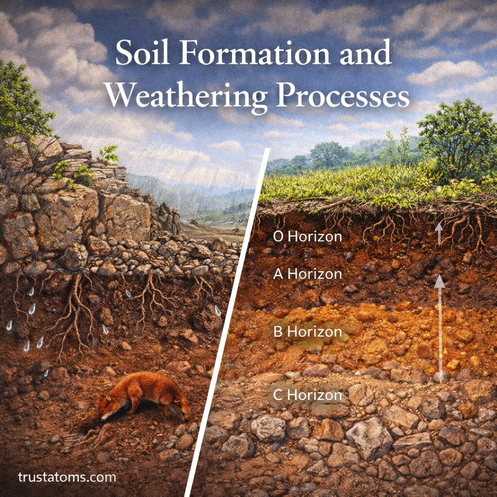
Illustration of soil formation and weathering showing rock breakdown and soil horizons layers beneath the surface.
Illustration showing how weathered rock, organic matter, and distinct soil horizons develop beneath the ground surface.

Soil forms as rocks and sediments undergo physical, chemical, and biological weathering while organic matter accumulates and mixes with mineral particles. Over time, water, organisms, climate, and landscape conditions transform this material into soil with distinct layers that support plant growth and other living things.

Understanding soil formation and weathering processes helps explain how landscapes develop and how ecosystems are sustained. These changes connect geology, biology, and the atmosphere, making soil development an important subject in Earth science.

Continue reading “Soil Formation and Weathering Processes”

Volcanic Rocks and Magma Formation

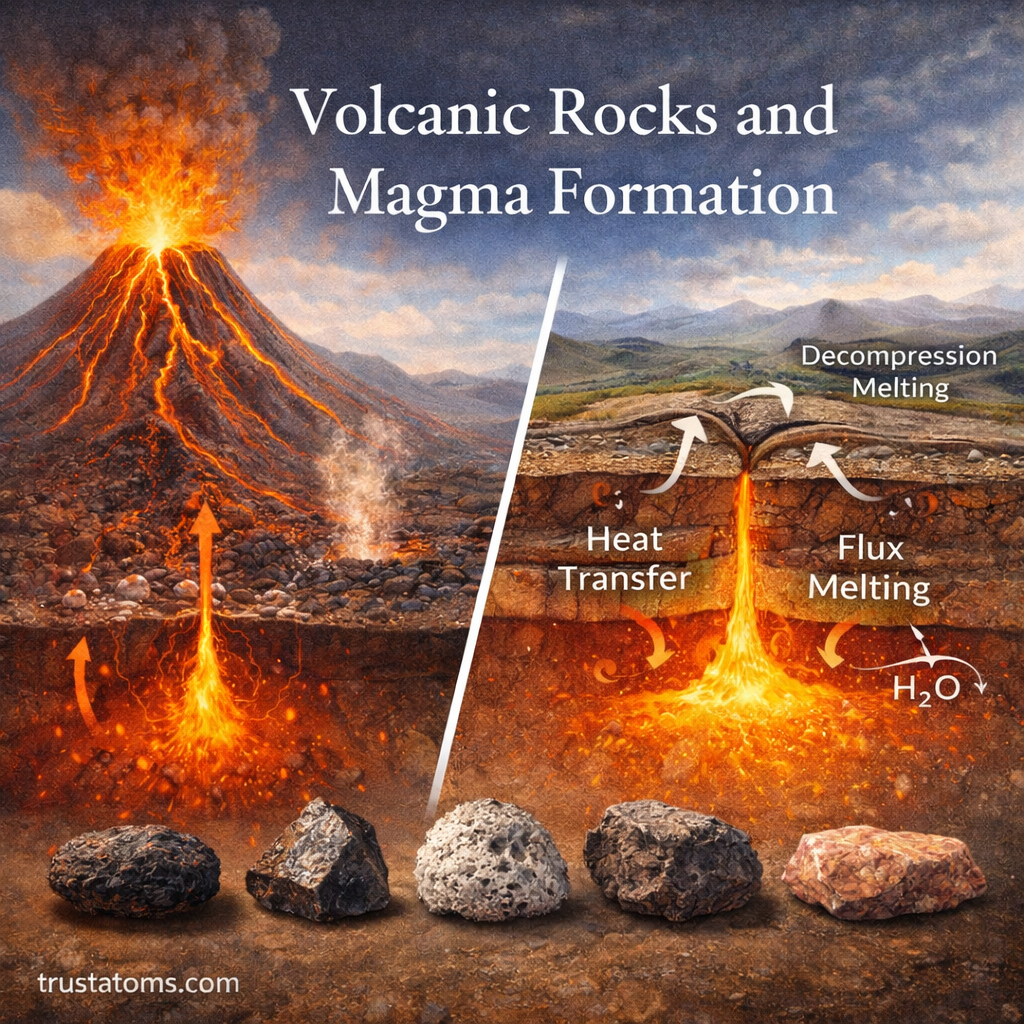
Illustration of volcanic rocks and magma formation showing an erupting volcano and underground magma processes.
Magma forms beneath Earth’s surface and can rise through the crust before cooling into volcanic rocks such as basalt, andesite, and rhyolite.

Volcanic rocks form when molten rock reaches or approaches Earth’s surface and cools into solid material, while magma forms when portions of hot rock melt beneath the surface. Differences in melting conditions, chemical composition, gas content, and cooling rate explain why volcanic rocks range from dense basalt to glassy obsidian and porous pumice.

Understanding magma formation and volcanic rocks helps explain volcanic eruptions, the creation of new land, and the evolution of Earth’s crust over time. These processes are central to Earth science because they connect Earth’s internal heat with changes at its surface.

Continue reading “Volcanic Rocks and Magma Formation”

Earth’s Internal Heat and Energy Sources

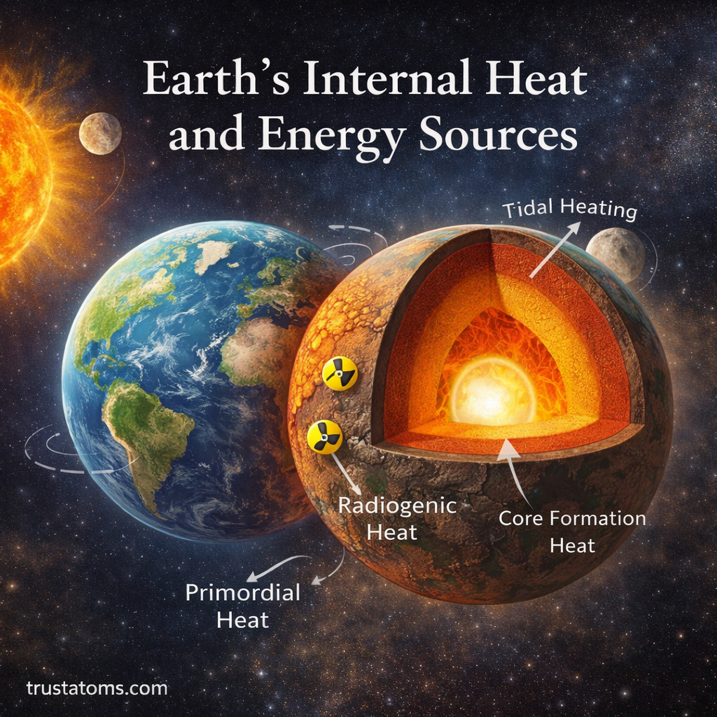
Illustration of Earth’s internal heat showing a cross-section of the planet with core, mantle, and energy sources like radiogenic and primordial heat.
Earth’s internal heat comes mainly from energy retained during planetary formation and the ongoing radioactive decay of elements within its interior.

Earth’s internal heat comes primarily from energy left over from the planet’s formation and heat continuously released by radioactive decay. This thermal energy moves through the core, mantle, and crust, contributing to mantle convection, volcanic activity, and the geological processes that reshape Earth’s surface.

Although the surface feels relatively cool, temperatures increase dramatically with depth. Studying this hidden energy is an important part of Earth science because it helps explain everything from mountain formation to earthquakes and even the structure of Earth’s internal layers.

Earth’s internal heat continues to shape the planet from within. It contributes to the movement of tectonic plates, drives volcanic activity, and supplies energy to geothermal systems beneath the surface.

Continue reading “Earth’s Internal Heat and Energy Sources”

Radiometric Dating in Geology

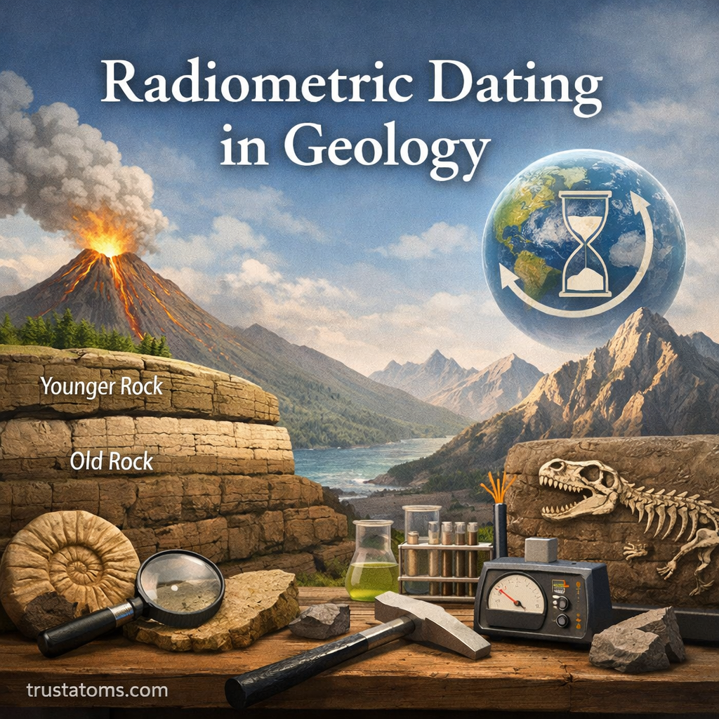
Illustration showing radiometric dating in geology with rock layers, volcanic activity, fossils, and scientific tools.
Illustration of radiometric dating in geology showing rock layers, fossils, and dating processes.

Radiometric dating is a scientific method for determining the age of rocks and minerals by measuring the radioactive decay of naturally occurring isotopes. Geologists compare radioactive parent isotopes with their decay products to calculate how much time has passed since a mineral formed or its isotopic clock was last reset.

Within Earth science, radiometric dating provides numerical ages that complement observations of rock layers, fossils, and geological structures. Multiple independent dating methods contribute to the scientific estimate that Earth formed approximately 4.54 billion years ago.

Continue reading “Radiometric Dating in Geology”

Geologic Time Scale and Earth History

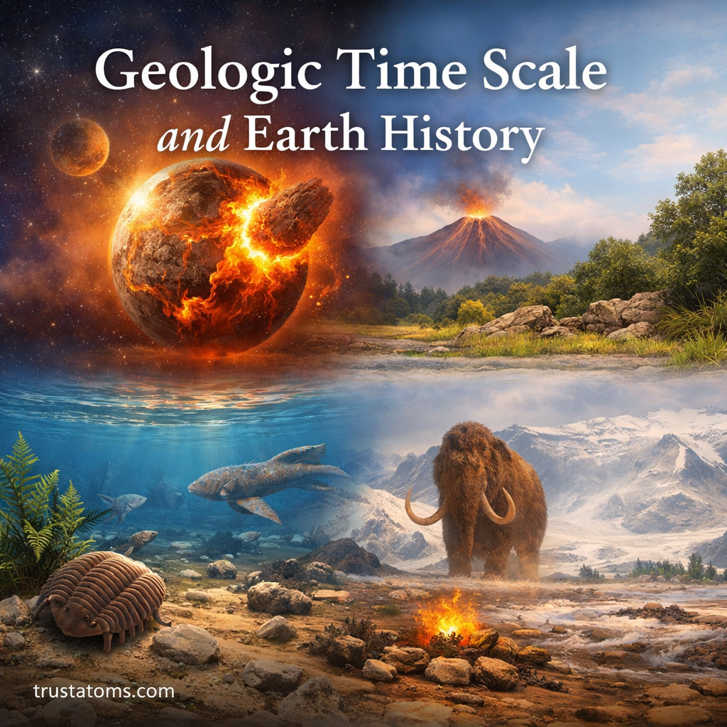
Illustration showing Earth’s geologic time scale with early molten Earth, volcanic landscape, ocean life, and ice age mammoth.
The geologic time scale organizes Earth’s history using evidence of changing rocks, environments, and life through successive intervals.

The geologic time scale is a scientific framework that divides Earth’s approximately 4.54-billion-year history into eons, eras, periods, epochs, and ages. Scientists construct this timeline using evidence from rock layers, fossils, radiometric dating, and major geological events to establish when changes occurred and how they relate to one another.

From the formation of Earth’s earliest crust to the development of modern landscapes, geological evidence records an extensive sequence of environmental and biological changes. Understanding this history is part of Earth science, which examines the processes shaping our planet and the evidence scientists use to reconstruct its past.

Continue reading “Geologic Time Scale and Earth History”

Earth’s Magnetic Field and Geodynamo Processes

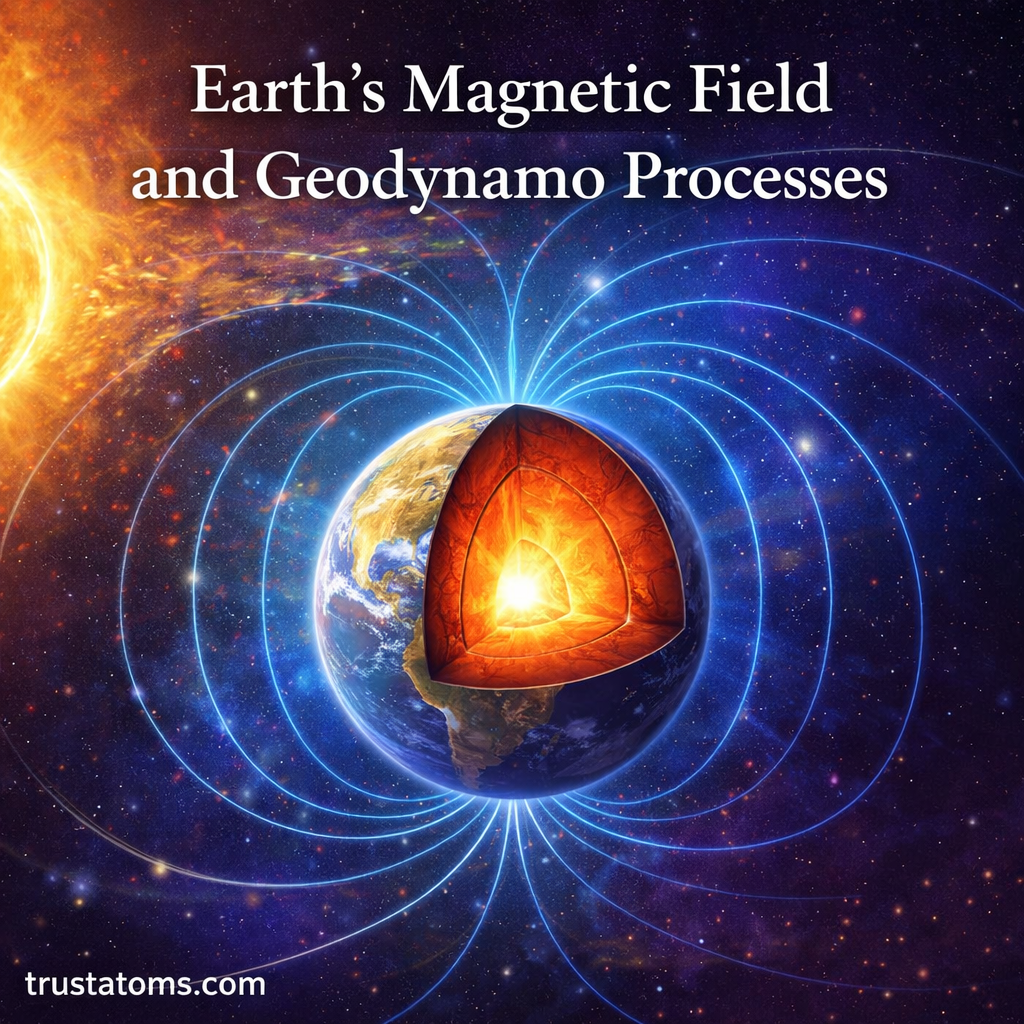
Illustration showing Earth’s magnetic field lines around a cutaway view of the core and geodynamo process.
Earth’s magnetic field is sustained by electric currents generated as electrically conducting liquid metal moves within the outer core.

Earth’s magnetic field is generated mainly by the geodynamo, a process involving the movement of electrically conducting liquid metal in the planet’s outer core. The resulting field extends into space, helps guide compass navigation, and forms a magnetosphere that influences how charged particles from the Sun interact with Earth.

Unlike a permanent bar magnet, Earth’s magnetic field changes as fluid motion deep inside the planet evolves. Studying these changes connects Earth science with electromagnetism, planetary interiors, space weather, and the geological record preserved in rocks.

The field is invisible, but its effects can be measured at the surface, observed by satellites, and traced through magnetic patterns recorded in ancient volcanic rocks and oceanic crust.

Continue reading “Earth’s Magnetic Field and Geodynamo Processes”

Minerals and Their Physical Properties

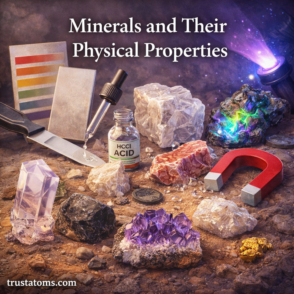
Illustration showing different minerals and tools used to test physical properties like hardness, streak, and magnetism.
Minerals can be identified by testing physical properties such as hardness, streak, luster, and magnetism.

Minerals are naturally occurring crystalline solids with characteristic chemical compositions, and their physical properties help distinguish one mineral from another. Geologists identify minerals by examining features such as hardness, streak, luster, cleavage, fracture, density, and crystal structure.

These properties explain why quartz scratches glass, mica separates into thin sheets, and magnetite may attract a magnet. Studying mineral identification is part of Earth science because minerals make up most rocks and provide clues about Earth’s geological processes.

Continue reading “Minerals and Their Physical Properties”

Igneous, Sedimentary, and Metamorphic Rocks

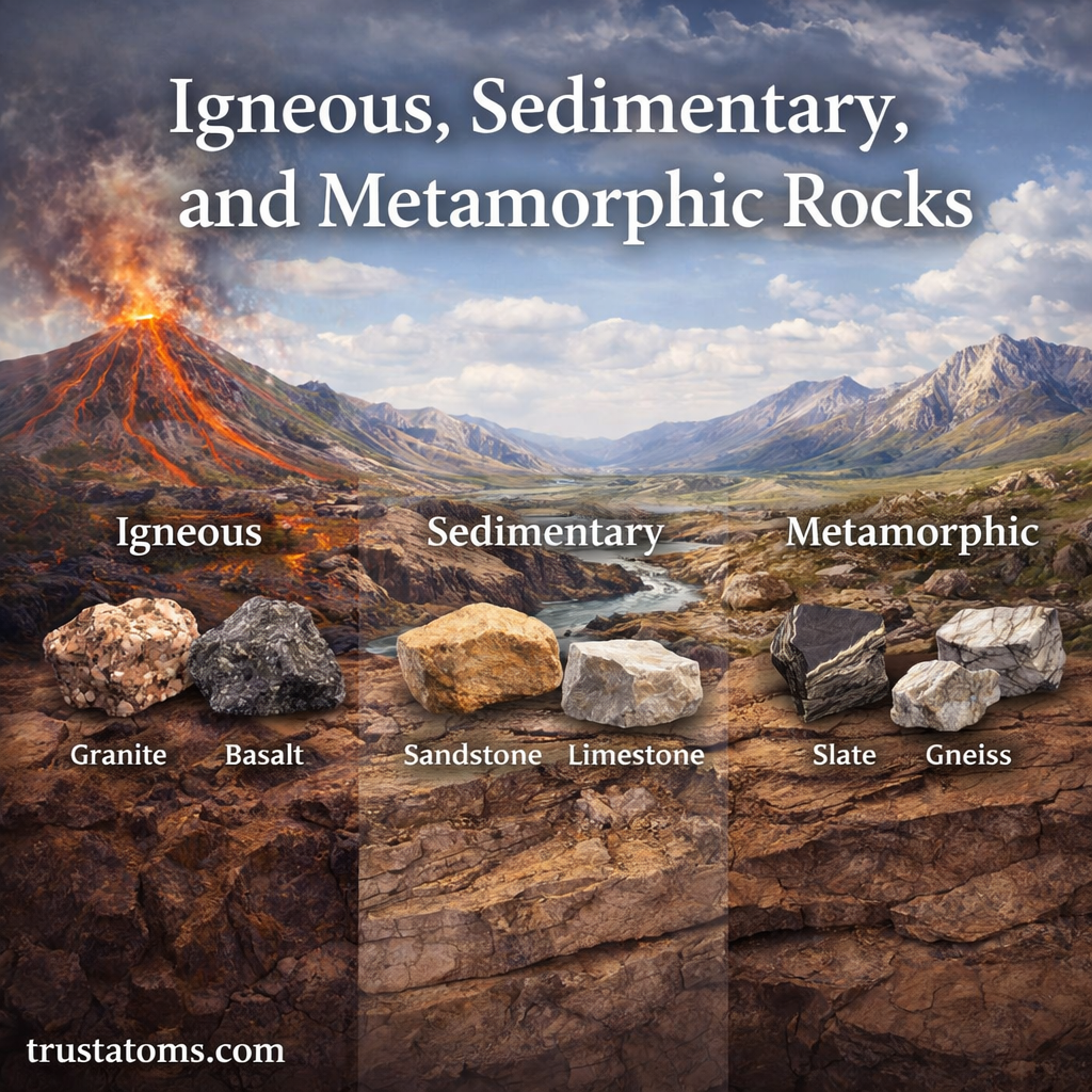
Illustration showing igneous, sedimentary, and metamorphic rocks with examples like granite, sandstone, and gneiss.
Illustration comparing igneous, sedimentary, and metamorphic rocks with common examples.

Igneous, sedimentary, and metamorphic rocks are the three main rock types, classified according to how they form. Igneous rocks solidify from molten material, sedimentary rocks form through sediment accumulation or mineral precipitation, and metamorphic rocks develop when existing rocks change under heat, pressure, or chemically active fluids without melting.

Each rock type preserves evidence of different geological processes, from volcanic eruptions to ancient oceans and mountain building. Understanding these materials is a basic part of Earth science because rocks provide clues about the formation of landscapes, the movement of tectonic plates, and the conditions that existed in past environments.

Continue reading “Igneous, Sedimentary, and Metamorphic Rocks”

The Rock Cycle and Earth Materials

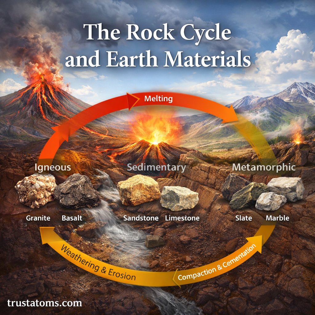
Rock cycle diagram showing igneous, sedimentary, and metamorphic rocks with processes like melting, weathering, erosion, and compaction and cementation.
Rock cycle illustration showing how Earth materials transform between igneous, sedimentary, and metamorphic rocks.

The rock cycle is the continuous set of natural processes that forms, breaks down, and transforms rocks between igneous, sedimentary, and metamorphic types. Earth materials change through melting, cooling, weathering, erosion, burial, heat, and pressure, often following different pathways rather than one fixed sequence.

These transformations explain how volcanic rock becomes sediment, how buried limestone turns into marble, and how rocks exposed at the surface gradually contribute to soil. The rock cycle is a central concept in Earth science because it connects processes occurring deep underground with changes visible across landscapes.

Continue reading “The Rock Cycle and Earth Materials”