Tectonic Plates and Lithosphere Structure

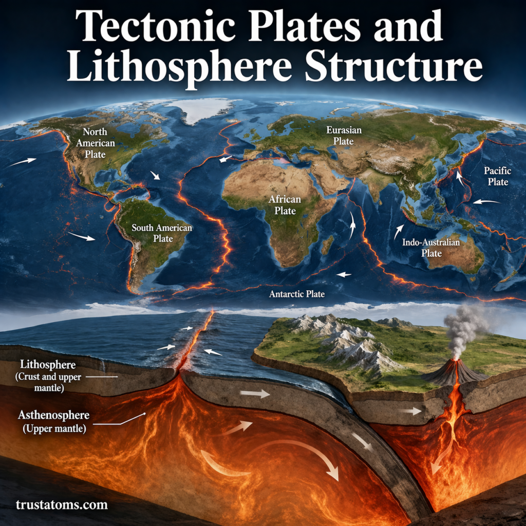
Illustration showing tectonic plates and lithosphere structure with labeled layers and plate boundaries.
Tectonic plates are rigid sections of Earth’s lithosphere, consisting of the crust and uppermost mantle above the weaker asthenosphere.

Tectonic plates are enormous moving sections of Earth’s lithosphere, the rigid outer shell made of the crust and uppermost mantle. Their slow movement and interactions at plate boundaries produce earthquakes, volcanoes, mountain ranges, ocean trenches, and new oceanic crust.

Although the ground appears stationary, Earth’s outer shell is continually shifting at rates usually measured in centimeters per year. Understanding the relationship between tectonic plates and the lithosphere is a central part of Earth science because it explains how geological forces reshape the planet’s surface.

Continue reading “Tectonic Plates and Lithosphere Structure”
Geological Mapping and Field Methods

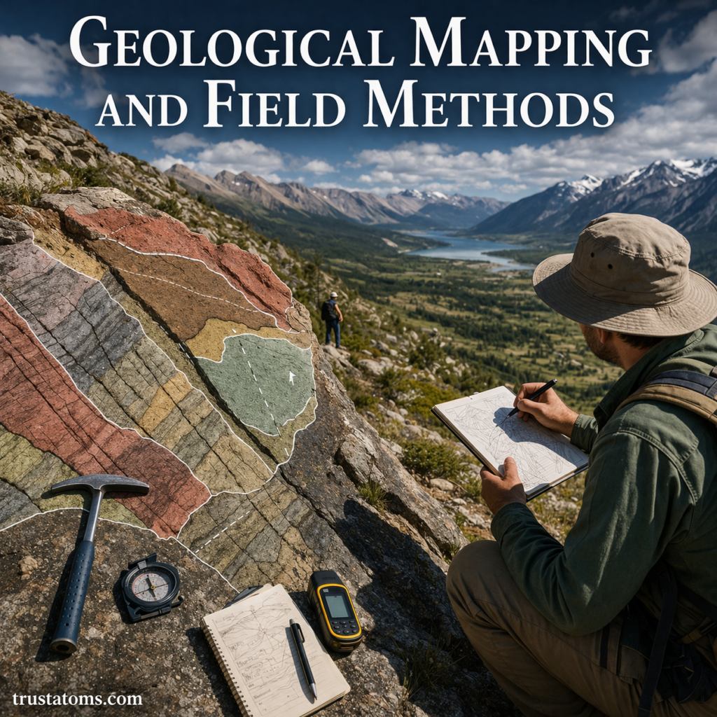
Illustration of geological mapping and field methods showing a geologist analyzing rock layers with tools in a mountainous landscape.
A geologist examines exposed rock layers and records observations used to identify geological formations and structures.

Geological mapping is the process of identifying, measuring, and recording the distribution of rocks and geological structures across an area. Field methods provide the observations needed to create these maps, including rock identification, strike and dip measurements, sampling, and documentation of faults and rock boundaries.

By examining exposed rocks and comparing observations across locations, geologists can reconstruct geological events and investigate conditions beneath the surface. These techniques are fundamental to Earth science and support mineral exploration, groundwater studies, engineering, and natural hazard assessment.

Continue reading “Geological Mapping and Field Methods”

Sedimentary Basins and Stratigraphy

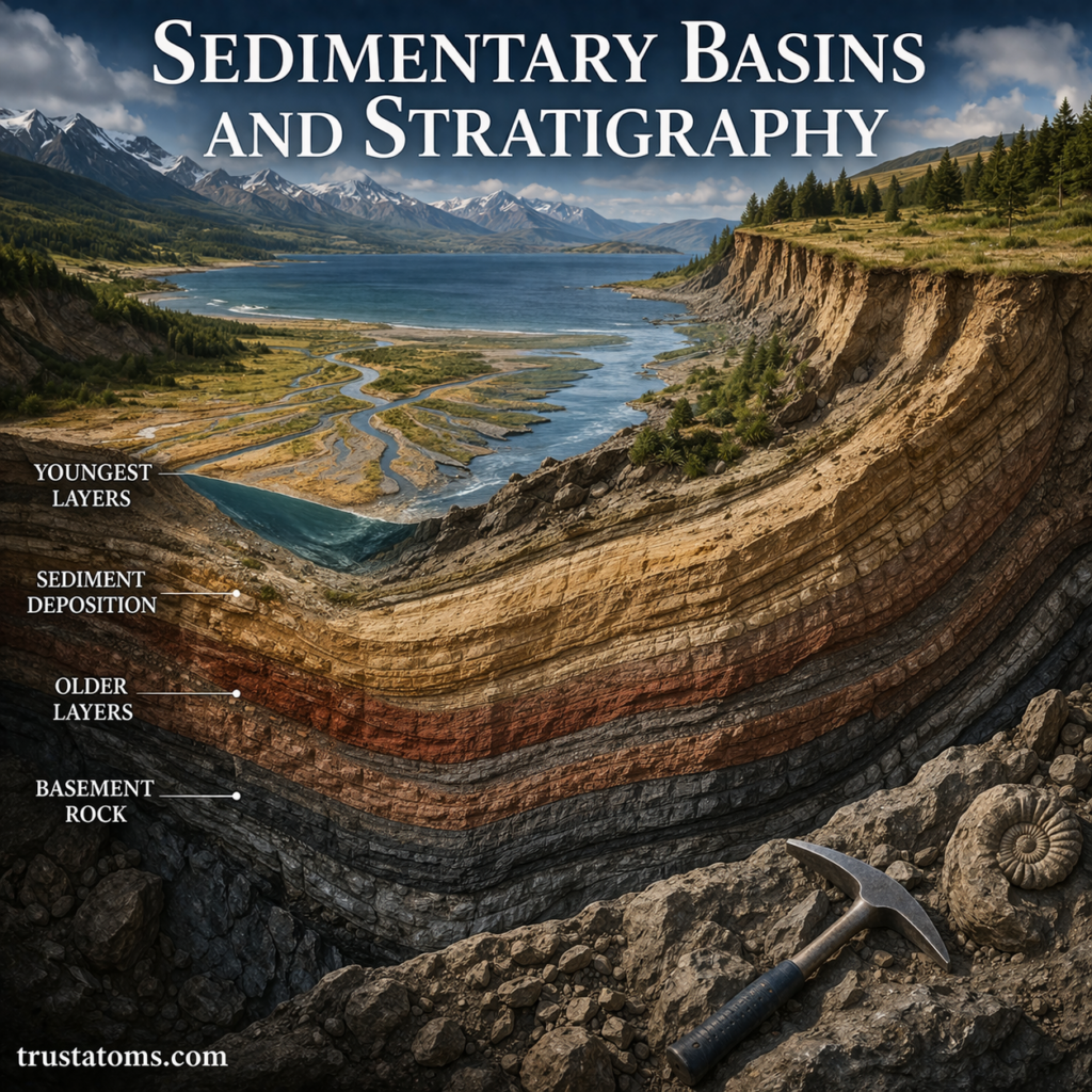
Illustration of sedimentary basins and stratigraphy showing layered rock formations, sediment deposition, and geological structure.
Diagram showing sedimentary basins and stratigraphy with layered rock formations and sediment buildup over time.

Sedimentary basins are regions where sediment accumulates over time, often as Earth’s crust gradually sinks and creates space for new deposits. Stratigraphy is the study of rock layers and their relationships, allowing geologists to reconstruct the sequence of events and environments recorded within those basins.

Together, these concepts help explain how ancient rivers, oceans, deserts, and changing landscapes leave evidence in sedimentary rocks. They are fundamental to Earth science, particularly the study of geological history, natural resources, and changes to Earth’s surface.

Continue reading “Sedimentary Basins and Stratigraphy”

Fossil Formation in Geological Context

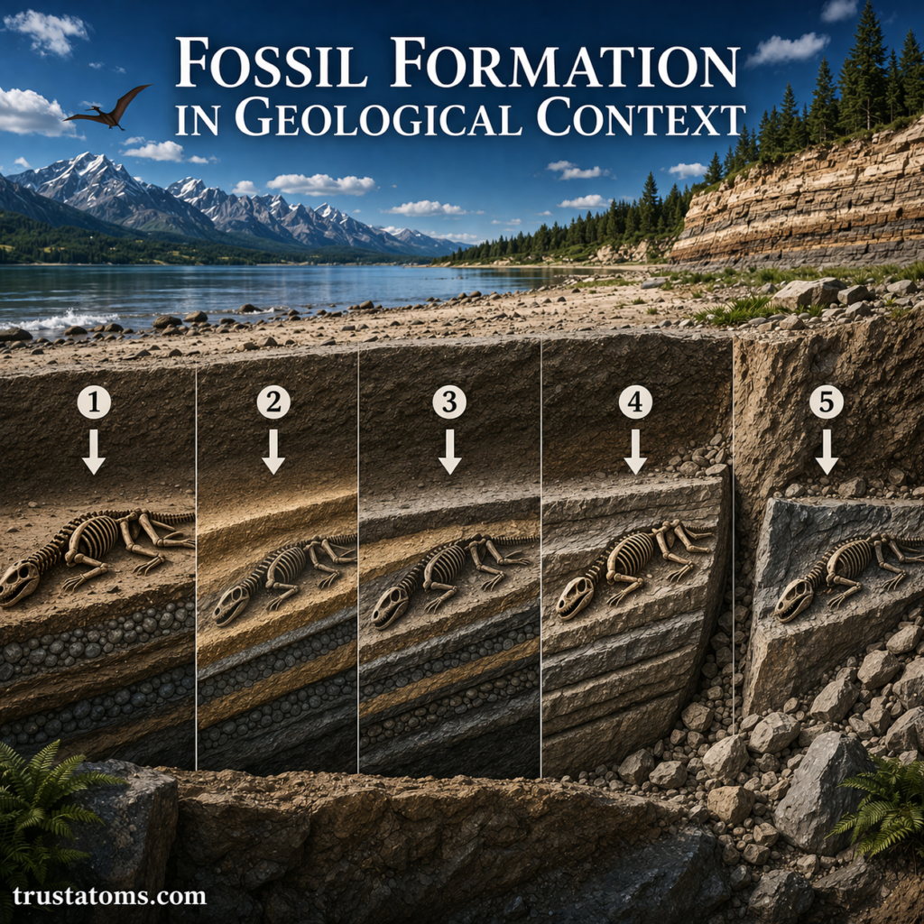
Illustration showing fossil formation stages in geological context with sediment layers and preserved skeleton over time.
Fossil formation can involve burial beneath sediment, mineral preservation within rock, and eventual exposure through erosion.

Fossils form when the remains or traces of organisms are preserved through processes such as rapid burial, mineralization, or the formation of impressions in sediment. Their geological context—the surrounding rock layers, sediments, and evidence of past environments—helps scientists determine how they formed and what they reveal about earlier life on Earth.

Most organisms never become fossils because decomposition, scavenging, and erosion destroy their remains. Understanding the conditions that allow preservation is part of Earth science, connecting the study of rocks with evidence of past environments and biological history.

Continue reading “Fossil Formation in Geological Context”

Isostasy and Crustal Balance

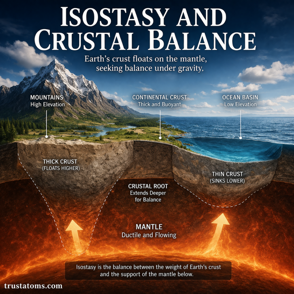
Illustration of isostasy and crustal balance showing mountains, ocean basins, and Earth’s crust floating on the mantle with varying thickness.
Diagram showing isostasy and crustal balance with thick continental crust and thinner oceanic crust supported by the mantle.

Isostasy is the gravitational balance that allows Earth’s lithosphere to rest at different elevations on the denser, slowly deforming mantle beneath it. This balance explains why thick mountain crust extends deep underground, why ocean basins lie lower than continents, and why land can rise after heavy ice sheets melt.

Although Earth’s crust appears rigid and stable, its elevation changes as weight is added or removed. Understanding isostasy through Earth science helps connect mountain formation, erosion, glacial melting, and the movement of tectonic plates to changes in Earth’s surface.

Continue reading “Isostasy and Crustal Balance”

Continental Drift Theory Development

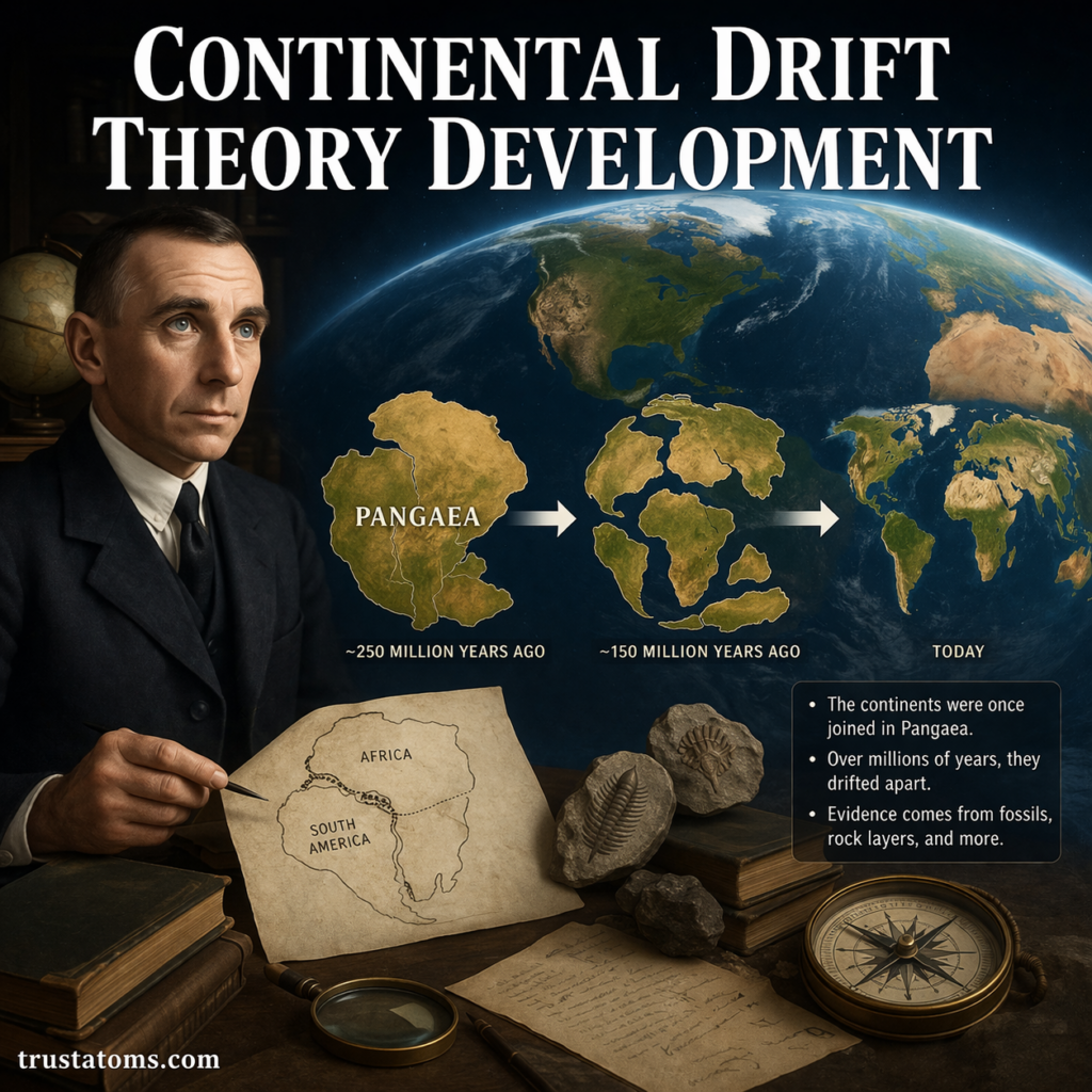
Illustration showing continental drift theory development with Pangaea breaking apart into modern continents and a scientist studying early evidence.
Continental drift theory developed from evidence that the continents were once joined and later moved into their present positions.

Continental drift theory developed from early observations that continents appeared to fit together, followed by Alfred Wegener’s 1912 hypothesis that they had moved across Earth’s surface. Fossil discoveries, matching rock formations, and later evidence from the ocean floor helped transform this controversial idea into the modern theory of plate tectonics.

The development of continental drift changed how scientists explain Earth’s geological history, mountain ranges, earthquakes, and the distribution of ancient organisms. It remains an important chapter in Earth science because it demonstrates how multiple independent observations can lead to a more complete scientific explanation.

Continue reading “Continental Drift Theory Development”

Mountain Building Processes

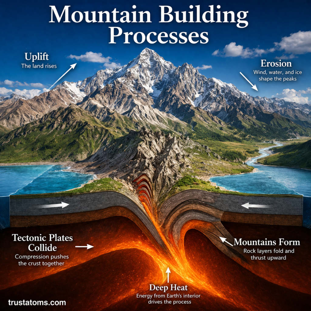
Illustration showing mountain formation from tectonic plate collision, uplift, and erosion with a cross-section of Earth’s crust.
Diagram showing how tectonic plate collision, crustal uplift, and erosion contribute to the development of mountain landscapes.

Mountain building processes create elevated landscapes through tectonic plate collisions, crustal folding, faulting, and volcanic activity. These geological forces deform and raise Earth’s crust over long periods, while erosion gradually reshapes the resulting mountains.

Geologists call the development of mountain belts orogeny, a process closely connected to plate tectonics and Earth’s internal energy. Studying mountain formation is part of Earth science because it reveals how the planet’s interior, surface, and atmosphere interact.

Continue reading “Mountain Building Processes”

Seismic Waves and Earth’s Interior

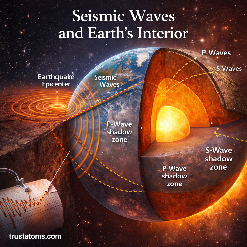
Illustration showing seismic waves traveling through Earth’s interior with crust, mantle, and core layers.
Visual diagram of seismic waves moving through Earth’s layers, illustrating how scientists study the planet’s interior.

Seismic waves reveal Earth’s interior by changing speed, direction, and behavior as they pass through different underground materials. Scientists analyze these changes to identify the crust, mantle, liquid outer core, and solid inner core without directly observing most of the planet’s interior.

These vibrations provide evidence about the physical properties and boundaries of Earth’s internal layers. Studying them is a major part of Earth science, connecting earthquake observations with our understanding of the planet’s structure and geological processes.

Continue reading “Seismic Waves and Earth’s Interior”

Earth’s Density and Interior Structure

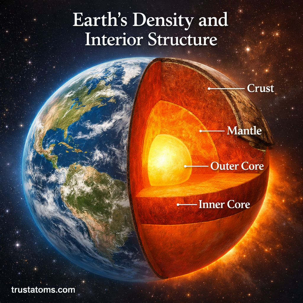
Illustration of Earth’s density and interior structure showing crust, mantle, outer core, and inner core layers.
Earth’s interior consists of a thin rocky crust, a thick silicate mantle, a liquid metallic outer core, and a solid inner core, with density generally increasing toward the center.

Earth has an average density of approximately 5.51 grams per cubic centimeter (g/cm³), but its interior is not uniformly dense. The planet consists of a relatively light rocky crust, a much thicker mantle, and a dense metallic core, with pressure and composition causing density to generally increase toward the center.

Understanding Earth’s density and internal structure helps explain gravity, earthquakes, volcanic activity, and the magnetic field. Although scientists cannot directly observe most of Earth’s interior, they have developed reliable models using seismic waves, rock samples, and physics, combining several methods used in Earth science.

The contrast between surface rocks and the deep interior also reveals how Earth separated into layers and why materials behave differently under extreme pressure and temperature.

Continue reading “Earth’s Density and Interior Structure”

Plate Boundaries and Crustal Movement

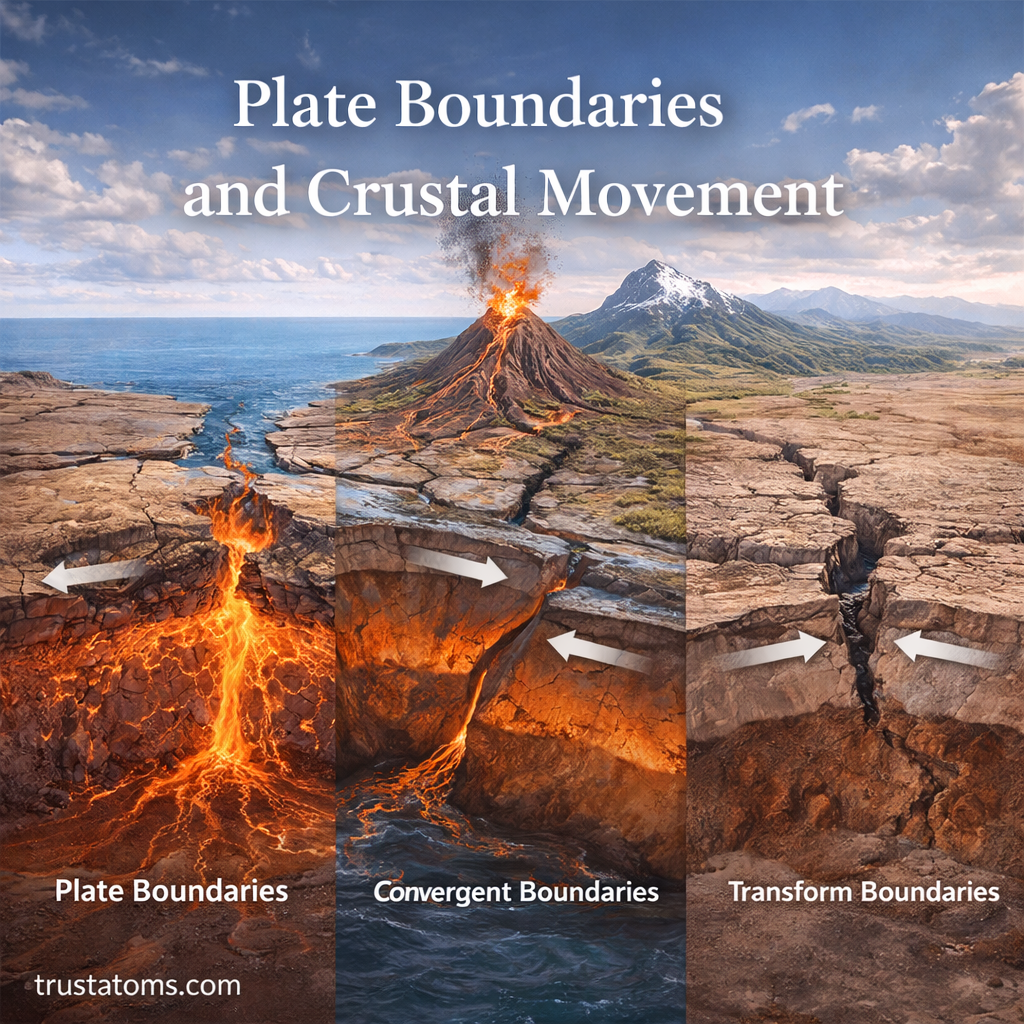
Illustration of plate boundaries and crustal movement showing divergent, convergent, and transform plate interactions.
Illustration of plate boundaries and crustal movement showing how tectonic plates interact.

Plate boundaries are places where sections of Earth’s outer rocky shell meet and move apart, collide, or slide past one another. These movements reshape the crust, producing earthquakes, volcanic activity, mountain ranges, and new ocean basins over geological time.

Most plate movement is too slow to notice directly, but its accumulated effects can transform entire landscapes. Understanding these processes is part of Earth science, which examines the physical systems and geological forces that shape our planet.

Continue reading “Plate Boundaries and Crustal Movement”