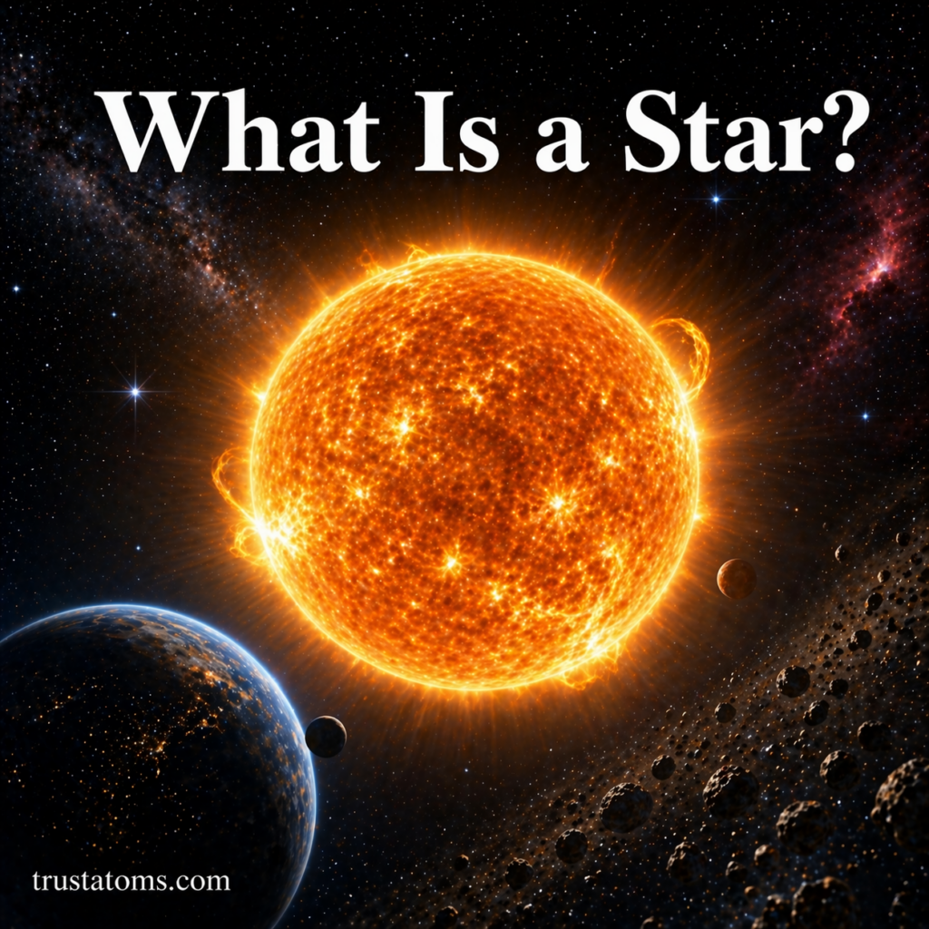
Coral Reefs and Marine Ecosystems

Vibrant coral reef ecosystem with diverse marine life including fish, sea turtle, and dolphin in clear tropical ocean water.
Colorful coral reef ecosystem showcasing marine biodiversity with fish, sea turtle, and ocean life in clear waters. trustatoms.com

Coral reefs are among the most diverse and valuable ecosystems on Earth. Often called the “rainforests of the sea,” they support a vast array of marine life while protecting coastlines and sustaining human communities.

Understanding coral reefs and their role in marine ecosystems is essential for preserving ocean biodiversity and maintaining environmental balance.

Continue reading “Coral Reefs and Marine Ecosystems”

Ocean Currents and Climate Interaction

Illustration of Earth showing ocean currents with warm and cold water movement influencing global climate patterns.
Global diagram of ocean currents showing how warm and cold water circulation impacts climate systems. trustatoms.com

Ocean currents are powerful, continuous movements of seawater that play a major role in shaping Earth’s climate. Acting like a global transport system, these currents move heat, nutrients, and gases across the planet.

Understanding how ocean currents interact with climate helps explain weather patterns, regional temperatures, and long-term environmental changes.

Continue reading “Ocean Currents and Climate Interaction”

Tides and Gravitational Forces

Illustration showing Earth, Moon, and Sun with gravitational forces influencing ocean tides and creating high and low tide patterns.
Diagram of tidal forces showing how the Moon and Sun influence ocean tides on Earth. trustatoms.com

Tides are the regular rise and fall of sea levels along coastlines, driven primarily by gravitational forces. While they may seem simple—water moving in and out—they are the result of complex interactions between the Earth, the Moon, and the Sun.

Understanding tides is essential for navigation, coastal ecosystems, and even climate systems.

Continue reading “Tides and Gravitational Forces”

Thermohaline Circulation in the Oceans

Illustration of thermohaline circulation showing global ocean conveyor belt with warm and cold currents moving across the Earth.
Global ocean circulation diagram showing warm surface currents and cold deep currents driving thermohaline circulation. trustatoms.com

Thermohaline circulation is one of the most important processes in Earth’s ocean system. Often called the “global conveyor belt,” it is a large-scale movement of ocean water driven by differences in temperature (thermo) and salinity (haline).

This circulation plays a critical role in regulating global climate, distributing heat, and supporting marine ecosystems.

Continue reading “Thermohaline Circulation in the Oceans”

Ocean Structure and Depth Zones

Accurate ocean depth zones diagram showing epipelagic, mesopelagic, bathypelagic, abyssopelagic, and hadal zones with correct depth ranges and marine life.
Accurate cross-section of ocean depth zones from sunlight layer to deep ocean trenches with marine life at each level. trustatoms.com

The ocean is not a uniform body of water—it is a complex, layered system shaped by light, pressure, temperature, and life. Understanding ocean structure and depth zones helps scientists study marine ecosystems, climate patterns, and the limits of life on Earth.

In this guide, we’ll break down how the ocean is structured both vertically and horizontally, and explore the unique characteristics of each depth zone.

Continue reading “Ocean Structure and Depth Zones”

Case Studies in Extreme Weather Events

Illustration showing multiple extreme weather events including hurricane, wildfire, flood, drought, and winter storm with title Case Studies in Extreme Weather Events.
Illustration of various extreme weather events including hurricanes, wildfires, floods, droughts, and winter storms. trustatoms.com

Extreme weather events are becoming more frequent and intense due to shifts in global climate systems. These events—ranging from hurricanes and heatwaves to floods and wildfires—offer valuable insights into atmospheric processes, human vulnerability, and disaster preparedness.

In this article, we’ll explore real-world case studies of extreme weather events, examining their causes, impacts, and lessons for the future.

Continue reading “Case Studies in Extreme Weather Events”

Cold Waves and Arctic Air Intrusions: How Extreme Cold Impacts Weather and Society

Cold waves and Arctic air intrusions illustration showing people exposed to extreme winter conditions with snow, wind, and a map of cold air moving south.
Extreme cold conditions impacting people during an Arctic air intrusion, with snow, wind, and freezing temperatures. trustatoms.com.

While much attention is given to extreme heat, cold waves can be just as dangerous—sometimes even more so. Sudden drops in temperature, driven by Arctic air intrusions, can disrupt daily life, damage infrastructure, and pose serious health risks.

Understanding how these events form and how they affect people and the environment is essential for preparedness and safety.

Continue reading “Cold Waves and Arctic Air Intrusions: How Extreme Cold Impacts Weather and Society”

Heat Index and Human Impact: Understanding How Heat Affects the Body

Heat index and human impact illustration showing people affected by extreme heat, including an elderly man, worker, and child under intense sun and high temperatures.
Extreme heat conditions affecting vulnerable individuals, highlighting the human impact of high heat index levels. trustatoms.com.

Extreme heat is one of the leading weather-related health risks worldwide. While temperature alone tells part of the story, the heat index provides a more accurate measure of how hot it actually feels to the human body.

Understanding the heat index and its effects is essential for staying safe, especially during heatwaves and in regions with high humidity.

Continue reading “Heat Index and Human Impact: Understanding How Heat Affects the Body”

Cyclone Tracking and Prediction: How Scientists Monitor and Forecast Powerful Storms

Cyclone tracking and prediction illustration showing satellite monitoring, aircraft reconnaissance, meteorologist analyzing storm data, and a hurricane approaching coastline.
Cyclone tracking visualization featuring satellites, aircraft data collection, and real-time storm monitoring near coastal areas. trustatoms.com.

Cyclones are among the most powerful and destructive weather systems on Earth. Accurate tracking and prediction are essential for minimizing damage, protecting lives, and improving emergency response.

Advancements in science and technology have made it possible to monitor cyclones in real time, providing early warnings and more reliable forecasts than ever before.

Continue reading “Cyclone Tracking and Prediction: How Scientists Monitor and Forecast Powerful Storms”

Floodplain Mapping and Risk Management: Understanding Risk, Reducing Damage, and Planning Smarter

Floodplain mapping and risk management illustration showing flood zone maps, residential flooding, and digital tools used to assess flood risk.
Floodplain mapping visualization with risk zones, flooded neighborhood, and digital analysis tools. trustatoms.com.

Flooding is one of the most common and costly natural hazards worldwide. As populations grow and development expands into vulnerable areas, understanding flood risk becomes increasingly important.

Floodplain mapping and risk management are essential tools used by scientists, planners, and communities to predict flooding, guide development, and protect lives and property.

Continue reading “Floodplain Mapping and Risk Management: Understanding Risk, Reducing Damage, and Planning Smarter”