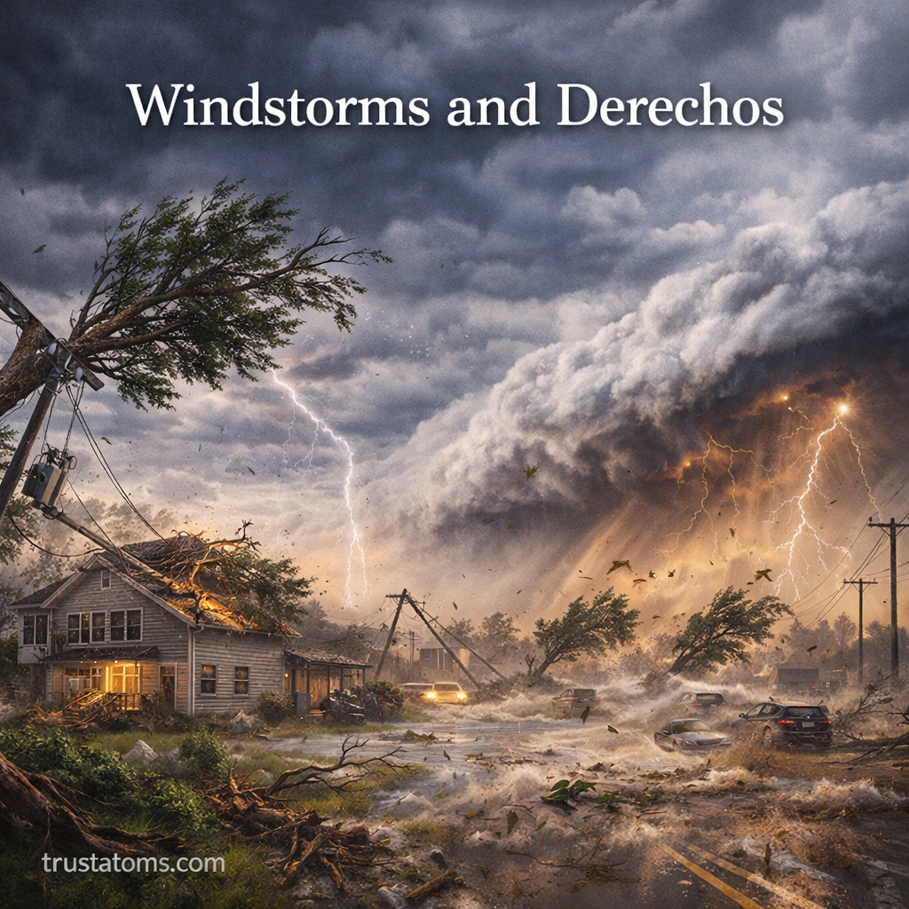
Windstorms and derechos are powerful atmospheric events capable of causing widespread damage over large areas. While many people are familiar with tornadoes and hurricanes, derechos are less well-known but can be just as destructive due to their scale and intensity.
This guide explores how windstorms and derechos form, what makes them unique, and the risks they pose.
What Are Windstorms?
Windstorms are weather events characterized by strong, sustained winds or powerful gusts. They can occur in various forms and environments, including:
- Thunderstorms
- Cold fronts
- Extratropical cyclones
- Mountain and coastal regions
Windstorms vary in intensity, from moderate gusts to extreme events capable of damaging infrastructure and ecosystems.
What Is a Derecho?
A derecho is a specific type of widespread, long-lived windstorm associated with a band of rapidly moving thunderstorms.
To be classified as a derecho, a storm system must meet certain criteria:
- Wind damage extending over at least 240 miles (about 400 km)
- Wind gusts of at least 58 mph (93 km/h) along most of its path
- Several well-separated severe wind reports
Derechos often form in warm-season conditions and can travel hundreds of miles, causing continuous damage along their path.
How Windstorms and Derechos Form
Key Ingredients
Both windstorms and derechos rely on similar atmospheric conditions:
- Strong Instability
Warm, moist air near the surface rises quickly into cooler air above. - Wind Shear
Changes in wind speed and direction with height help organize storms into long-lasting systems. - Lift Mechanism
Fronts, outflow boundaries, or pressure systems trigger upward motion.
The Derecho Formation Process
Derechos typically evolve from organized thunderstorm systems such as squall lines.
- Thunderstorms cluster into a line
- Strong downdrafts form as rain-cooled air descends
- This air spreads outward, creating powerful straight-line winds
- The system accelerates and sustains itself over long distances
A key feature is the “bow echo” shape seen on weather radar, indicating strong winds pushing forward.
Types of Windstorms
Windstorms can occur in several forms depending on their origin.
Thunderstorm Windstorms
- Caused by downdrafts and gust fronts
- Often produce sudden, intense wind bursts
Synoptic-Scale Windstorms
- Associated with large weather systems like low-pressure areas
- Can last for hours or days
Mountain and Downslope Winds
- Occur when air flows over mountains and accelerates downhill
- Examples include Chinook and Santa Ana winds
Key Features of Derechos
Derechos have distinct characteristics that set them apart from other windstorms.
Widespread Impact
- Cover hundreds of miles
- Affect multiple states or regions
Straight-Line Winds
- Unlike tornadoes, winds move in one direction
- Can reach speeds over 100 mph (160 km/h)
Rapid Movement
- Travel quickly, sometimes over 50–60 mph
- Leave little time for preparation
Bow Echo Formation
- Radar signature shaped like a bow
- Indicates strong forward-moving winds
Hazards Associated with Windstorms and Derechos
These events can produce significant and sometimes underestimated dangers.
Structural Damage
- Roof damage and collapsed buildings
- Broken windows and siding
Power Outages
- Downed power lines
- Widespread electrical disruptions lasting days
Falling Trees and Debris
- Trees uprooted or snapped
- Flying debris posing serious safety risks
Transportation Disruptions
- Hazardous driving conditions
- Delays or cancellations in air and rail travel
Derechos vs Tornadoes

While both can cause severe damage, they differ in key ways:
Derechos
- Damage occurs along a long, continuous path
- Winds are straight-line
- Affect large regions simultaneously
Tornadoes
- Damage is more localized
- Winds rotate in a concentrated column
- Often shorter-lived but more intense in specific areas
Understanding this difference helps meteorologists assess damage patterns after storms.
Where Derechos Are Most Common
Derechos occur worldwide but are most frequent in certain regions:
- Central and eastern United States
- Midwest and Great Plains
- Parts of Europe and South America
In the U.S., derechos are most common during late spring and summer when heat and humidity are high.
How Meteorologists Predict Windstorms and Derechos
Forecasting these events involves analyzing atmospheric conditions and storm development patterns.
Tools Used
- Weather radar to track storm lines and bow echoes
- Satellites to monitor cloud growth
- Computer models to predict storm evolution
Warning Systems
- Severe thunderstorm watches and warnings
- High wind warnings
- Real-time alerts through weather services
Early warnings are critical due to the fast-moving nature of derechos.
Safety Tips During Windstorms and Derechos
Preparation and awareness can reduce the risk of injury and damage.
Before the Storm
- Secure outdoor furniture and loose objects
- Charge electronic devices
- Monitor weather alerts
During the Storm
- Stay indoors and away from windows
- Avoid driving unless necessary
- Move to an interior room on the lowest floor
After the Storm
- Avoid downed power lines
- Check for structural damage
- Use caution when clearing debris
Why Windstorms and Derechos Matter
Windstorms and derechos are significant because they:
- Impact large populations over wide areas
- Cause billions of dollars in damage annually
- Influence infrastructure planning and emergency response
Despite being less publicized than hurricanes or tornadoes, derechos can rival them in overall impact.
Final Thoughts
Windstorms and derechos are powerful examples of how atmospheric conditions can combine to produce large-scale, high-impact weather events. Their speed, reach, and intensity make them especially dangerous, often catching people off guard.
By understanding how these systems form and behave, individuals and communities can better prepare for and respond to severe wind events.