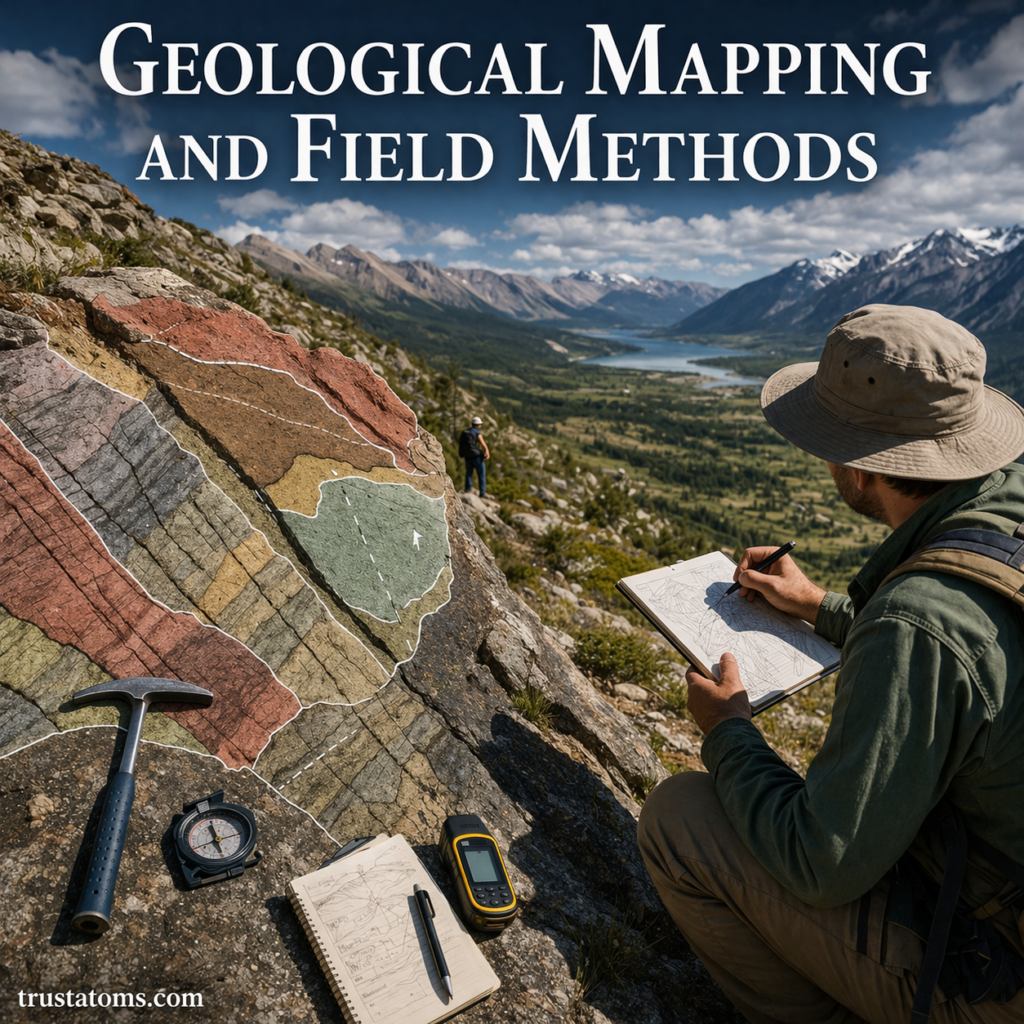
Geological mapping is the process of identifying, measuring, and recording the distribution of rocks and geological structures across an area. Field methods provide the observations needed to create these maps, including rock identification, strike and dip measurements, sampling, and documentation of faults and rock boundaries.
By examining exposed rocks and comparing observations across locations, geologists can reconstruct geological events and investigate conditions beneath the surface. These techniques are fundamental to Earth science and support mineral exploration, groundwater studies, engineering, and natural hazard assessment.
What Is Geological Mapping?
Geological mapping documents the locations, characteristics, and relationships of rock units and structures. Unlike a topographic map, which primarily shows land elevation, a geological map reveals the types of rocks present and how they are arranged.
Most geological maps use colors to distinguish rock units and lines to represent contacts, faults, and other boundaries. Symbols indicate the orientation of rock layers and structural features.
Studying folding and faulting in Earth’s crust helps explain why rock layers may be tilted, bent, or displaced. Research into sedimentary basins and stratigraphy provides additional evidence about the sequence and environments in which sedimentary rocks formed.
Field mapping also supports geological hazard mapping by locating faults, unstable slopes, and geological materials that may influence earthquake shaking or landslide susceptibility.
What Information Appears on a Geological Map?
A geological map combines several types of information to describe an area’s geology. Common features include:
- Rock units: Areas containing rocks with recognizable characteristics, commonly distinguished by color and labels.
- Geological contacts: Boundaries separating different rock units.
- Faults: Fractures along which rocks have moved relative to one another.
- Folds: Bends in rock layers produced by deformation.
- Strike and dip symbols: Measurements showing the orientation of planar geological features.
Many maps also include a legend, geological cross section, and explanatory notes. Together, these features help readers interpret the arrangement of rocks at the surface and infer their possible continuation underground.
Core Geological Field Methods
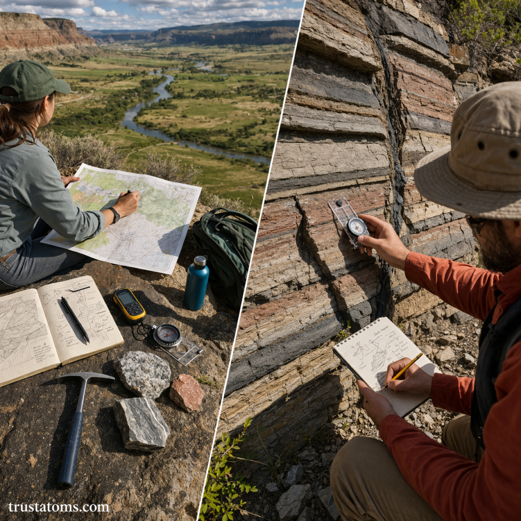
Identifying Rock Types
Geologists examine mineral composition, grain size, texture, color, and visible structures to identify rocks. Sedimentary rocks may contain bedding or fossils, igneous rocks may display interlocking crystals, and metamorphic rocks may show mineral alignment.
Field identification is sometimes uncertain, especially when rocks are weathered. Laboratory analysis can provide more detailed information about mineral composition and origin.
Measuring Strike and Dip
Strike and dip describe the orientation of a planar feature such as a sedimentary bed or fault surface.
- Strike: The compass direction of a horizontal line lying within the plane.
- Dip: The angle at which the plane slopes downward from horizontal, measured perpendicular to strike.
These measurements reveal whether layers are horizontal, tilted, or folded. When recorded at multiple locations, they help geologists interpret larger structures that may not be visible from a single outcrop.
Recording Field Notes and Locations
Field notes document observations, measurements, sketches, photographs, and geographic coordinates. Geologists distinguish direct observations from interpretations so that later analysis can be checked against the original evidence.
Collecting Geological Samples
Rock, mineral, soil, and fossil samples may be collected for laboratory investigation when permitted. Each sample should have a unique identifier, recorded location, and geological context. Laboratory testing may reveal mineral composition, chemical characteristics, or numerical ages.
Mapping Contacts and Faults
A geological contact marks a boundary between rock units. Geologists trace contacts across outcrops and use structural measurements to infer their positions where vegetation, soil, or sediment conceals the underlying rock.
Tools Used in Geological Fieldwork
Traditional instruments remain useful because they allow geologists to inspect and measure geological features directly. Modern positioning and mapping technologies improve documentation and spatial accuracy.
| Tool | Primary use |
|---|---|
| Compass-clinometer | Measuring strike, dip, and slope angles |
| Hand lens | Examining minerals and rock textures |
| Rock hammer | Exposing fresh rock surfaces and collecting permitted samples |
| GPS receiver | Recording geographic locations |
| Field notebook | Documenting observations and interpretations |
| GIS software | Organizing and displaying spatial geological data |
| Satellite imagery and lidar | Examining terrain and geological features across larger areas |
Additional Earth Science Tools and Measurement Techniques support geological measurements, data collection, and analysis in field and laboratory settings.
How Geologists Create a Geological Map
Mapping typically begins before fieldwork and continues through data analysis and interpretation.
- Review existing information: Examine topographic maps, aerial imagery, previous geological studies, and available access routes.
- Investigate outcrops: Identify rock types, record locations, and observe contacts and structures.
- Measure and document: Collect strike and dip readings, photographs, sketches, and relevant samples.
- Compile observations: Plot rock units, contacts, and structural measurements on a base map or within GIS software.
- Interpret geological relationships: Develop a map, cross sections, and an explanation of the area’s geological history.
A Practical Example: Measuring a Tilted Rock Layer
Imagine a geologist examining an exposed sandstone bed beside a road. Using a compass-clinometer, the geologist measures a strike of 090 degrees, indicating an east-west orientation, and a dip of 30 degrees toward the south.
The measurement indicates that the sandstone layer slopes downward toward the south at 30 degrees from horizontal. Additional measurements at nearby outcrops can show whether the layer maintains that orientation or bends into a larger fold.
By plotting these readings, the geologist can estimate the position of the sandstone beneath areas where it is covered by soil. The interpretation remains provisional until supported by additional observations.
How Geological Structures Reveal Past Events
Faults, folds, joints, and unconformities preserve evidence of geological processes. A fault that cuts across sedimentary layers formed after those layers were deposited. A fold indicates that originally deposited layers underwent deformation.
These relationships help establish the relative order of events. Combining field observations with appropriate dating methods can further constrain when deformation, intrusion, erosion, or deposition occurred.
Applications and Challenges of Geological Mapping
Geological maps support groundwater investigations, mineral exploration, engineering projects, and environmental assessments. Identifying geological hazards like earthquakes and landslides also depends partly on recognizing faults, unstable materials, and terrain conditions.
Field mapping has limitations. Vegetation, weathered surfaces, difficult terrain, and incomplete rock exposure can obscure geological boundaries. Access restrictions and safety hazards may also prevent direct examination of important locations.
Geologists address these gaps by comparing nearby exposures, using remote sensing, and identifying uncertain boundaries on their maps. A mapped contact inferred beneath soil cover should not be treated as equally certain as one observed directly.
Frequently Asked Questions
What is the difference between a geological map and a topographic map?
A geological map shows rock units, contacts, faults, and other geological features. A topographic map primarily represents the shape and elevation of the land surface, usually through contour lines.
What do strike and dip measurements tell geologists?
Strike describes the horizontal orientation of a planar geological feature, while dip describes its downward inclination. Together, they help geologists interpret tilted layers, folds, and faults.
Can geological maps show what lies underground?
Geological maps can support interpretations of subsurface rock arrangements, especially when combined with cross sections, boreholes, and geophysical measurements. However, underground boundaries inferred from surface observations may contain uncertainty.
Geological mapping transforms individual observations of rocks and structures into a spatial picture of an area’s geology. Measurements of contacts, faults, and rock orientations allow geologists to reconstruct past events and make informed interpretations of underground conditions. Even with satellite imagery and digital mapping software, careful field observations remain necessary for testing those interpretations.
Sources: U.S. Geological Survey (USGS), National Geologic Map Database; Geological Society of America, Geologic Mapping resources; Robert R. Compton, Geology in the Field.