Seafloor Spreading Mechanisms

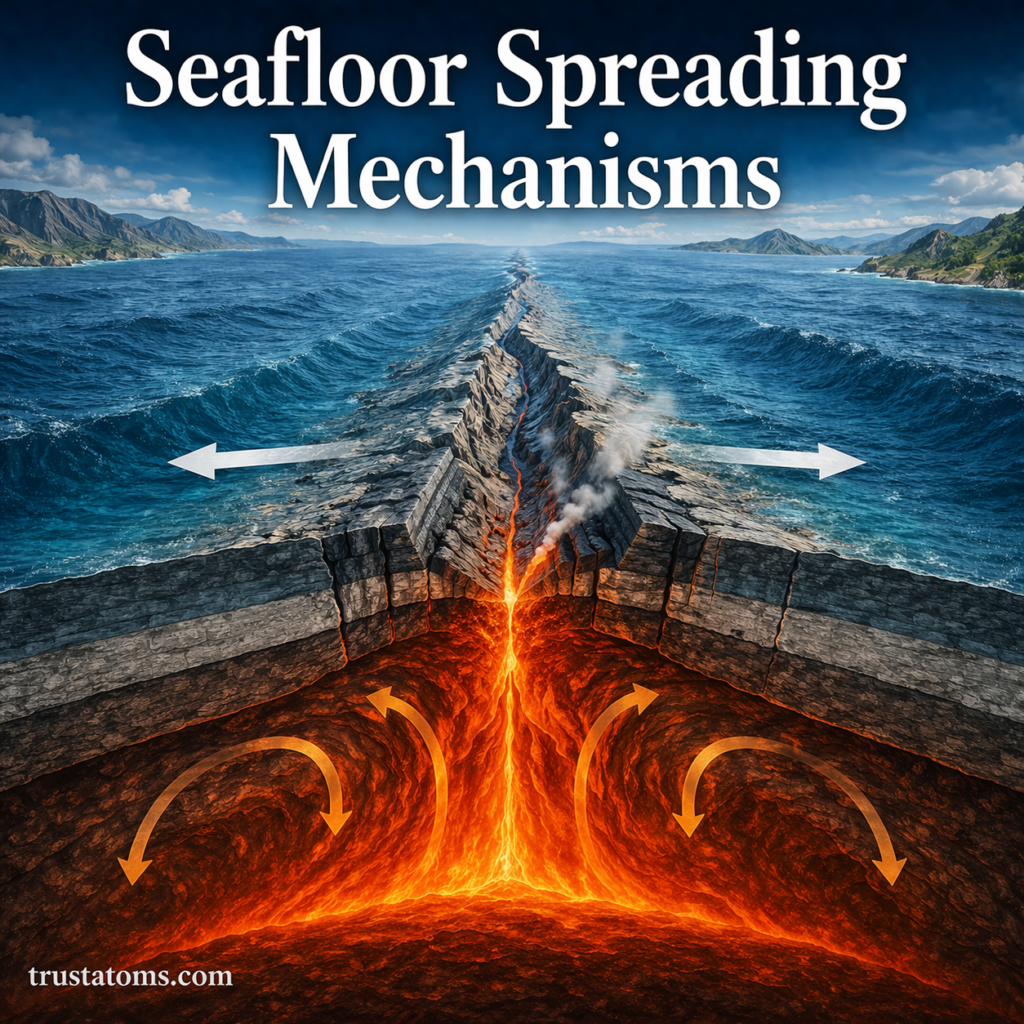
Illustration of seafloor spreading at a mid-ocean ridge with magma rising and tectonic plates moving apart.
Illustration of seafloor spreading showing magma upwelling and new oceanic crust formation at a mid-ocean ridge.

Seafloor spreading occurs when tectonic plates move apart at underwater ridges, allowing magma to rise, cool, and form new oceanic crust. The new crust moves outward as spreading continues, gradually changing the size and shape of ocean basins.

This process is a central part of Earth science because it connects the movement of tectonic plates with underwater volcanism, earthquakes, and the changing positions of continents. Scientists study ocean-floor rocks and magnetic patterns to reconstruct how spreading has occurred over geological time.

Continue reading “Seafloor Spreading Mechanisms”
Rift Valleys and Continental Separation

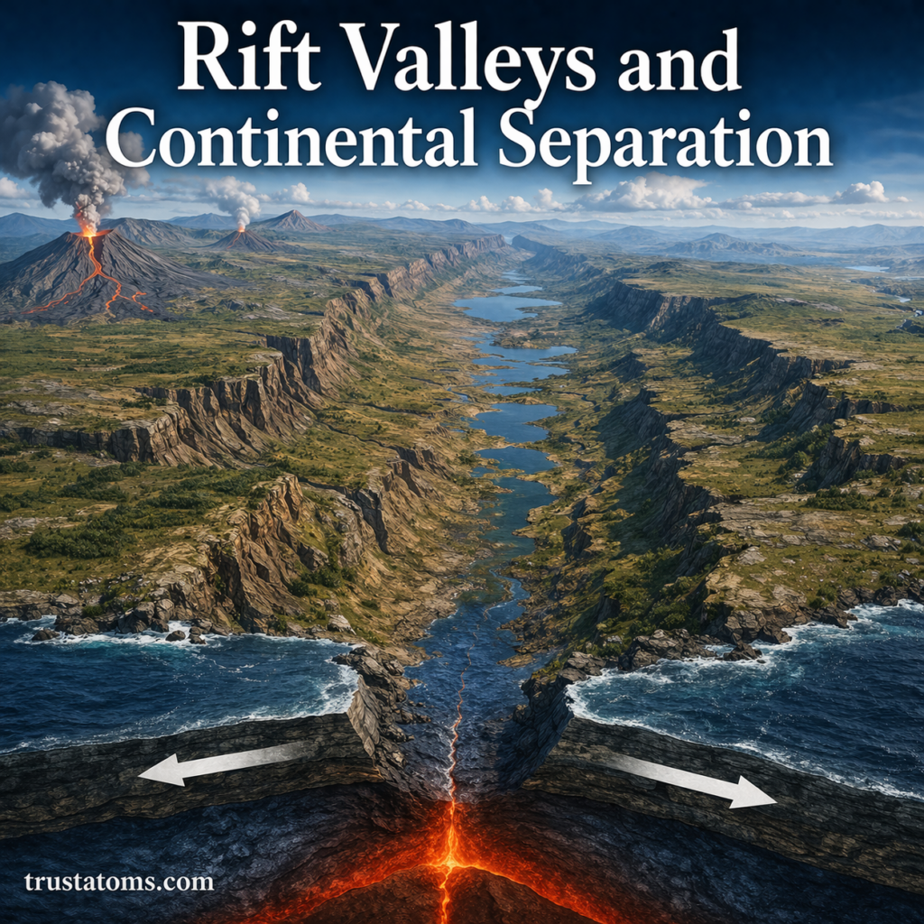
Illustration of a rift valley forming as continental plates pull apart with visible fault lines and rising magma.
Illustration of rift valley formation and continental separation driven by tectonic plate divergence.

Rift valleys are elongated depressions that form when Earth’s lithosphere stretches, fractures, and sinks along faults as parts of the crust move apart. Continued continental rifting can eventually split a landmass and create a new ocean basin, although many rifts stop developing before complete separation occurs.

In Earth science, rift valleys provide evidence of how tectonic forces reshape continents over geological time. Active examples, including the East African Rift, allow scientists to study crustal stretching, earthquakes, volcanism, and the early stages of ocean formation.

Continue reading “Rift Valleys and Continental Separation”

Volcanic Arcs and Island Chains

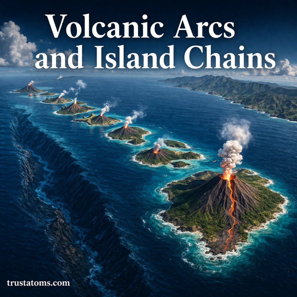
Illustration of volcanic arcs and island chains forming along a subduction zone with active volcanoes in the ocean.
A volcanic island arc forms above a subduction zone as magma rises through the overriding tectonic plate and builds a chain of volcanoes.

Volcanic arcs are chains of volcanoes that form above subduction zones, where one tectonic plate sinks beneath another and triggers magma production. Volcanic island chains can also develop above mantle hotspots, where moving plates carry older volcanoes away from areas of continuing volcanic activity.

These formations explain why volcanoes occur in recognizable patterns across oceans and continents. They also connect plate movement, earthquakes, and mountain building, making them useful examples of the processes studied in Earth science.

Continue reading “Volcanic Arcs and Island Chains”

Formation of Mountain Ranges

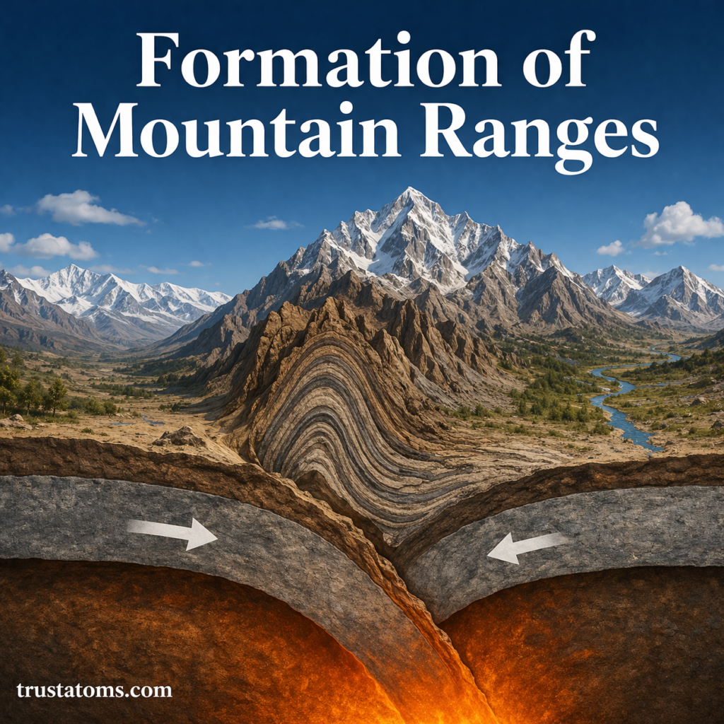
Illustration showing the formation of mountain ranges through tectonic plate collision and folding of Earth’s crust.
Tectonic compression can fold and thicken Earth’s crust, gradually building extensive mountain ranges.

Mountain ranges form when tectonic forces uplift, compress, fracture, or build up sections of Earth’s crust, creating connected groups of mountains. Plate collisions, fault movement, and volcanic eruptions produce different mountain structures, while erosion and weathering continually reshape them.

The Himalayas, Sierra Nevada, and volcanic peaks of Japan illustrate different ways mountains develop. Studying their formation is part of Earth science, which examines the processes that shape Earth’s surface and connect its geological, atmospheric, and water systems.

Continue reading “Formation of Mountain Ranges”

Transform, Convergent, and Divergent Boundaries

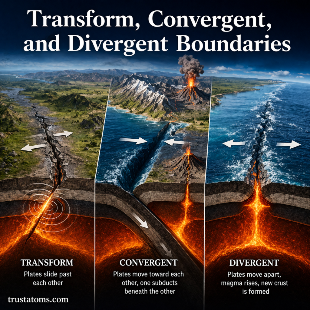
Diagram showing transform, convergent, and divergent plate boundaries with arrows indicating plate movement and magma activity.
Divergent boundaries separate tectonic plates, convergent boundaries bring them together, and transform boundaries allow them to slide past one another.

Transform, convergent, and divergent boundaries are the three main types of tectonic plate boundaries, distinguished by whether plates slide past, move toward, or move away from one another. These movements produce earthquakes, volcanic activity, mountain ranges, ocean trenches, and new oceanic crust.

Tectonic plate boundaries are where some of Earth’s most powerful geological activity occurs. Understanding their behavior is part of Earth science because plate movement connects processes inside Earth with changes visible at its surface.

Continue reading “Transform, Convergent, and Divergent Boundaries”

Theory of Plate Tectonics Explained

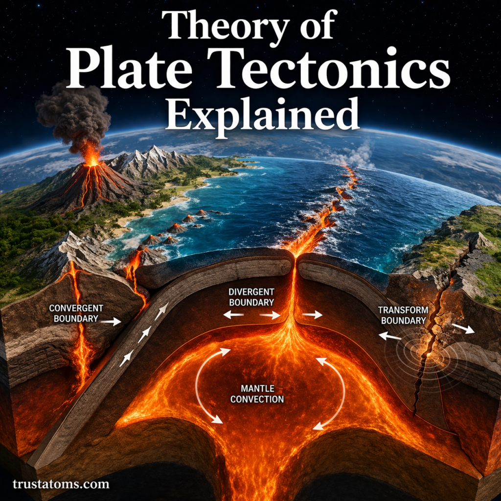
Diagram illustrating plate tectonics with divergent, convergent, and transform boundaries and magma movement beneath Earth’s surface.
Plate tectonics describes the movement of Earth’s rigid outer plates and their interactions at divergent, convergent, and transform boundaries.

The theory of plate tectonics explains how Earth’s rigid outer shell is divided into moving plates that interact to form mountains, ocean basins, earthquakes, and volcanoes. These plates typically move a few centimeters each year, driven by forces associated with Earth’s internal heat, mantle motion, and the sinking of dense oceanic lithosphere.

Although the movement is usually too slow to notice directly, its effects accumulate across geological time. Plate tectonics is a central concept in Earth science because it connects processes deep inside the planet with changes visible at its surface.

Continue reading “Theory of Plate Tectonics Explained”

Earth Science Tools and Measurement Techniques

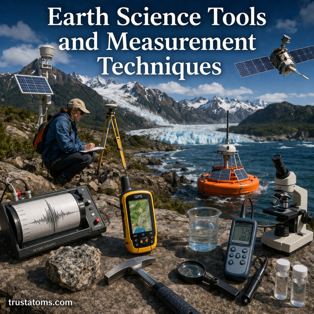
Illustration of Earth science tools including seismograph, GPS device, weather instruments, and ocean buoy in a natural landscape setting.
Collection of Earth science tools used to measure and study the planet’s systems.

Earth science tools are instruments used to observe and measure the atmosphere, oceans, rocks, soil, and processes occurring beneath Earth’s surface. Scientists combine direct measurements, remote sensing, laboratory analysis, and computer models to understand environmental changes, investigate geological activity, and assess natural hazards.

These methods form the practical foundation of Earth science, connecting observations with explanations of how the planet works. From a simple thermometer to a satellite orbiting Earth, each instrument measures particular properties and provides evidence that researchers can compare over time.

Continue reading “Earth Science Tools and Measurement Techniques”

Geological Hazards and Risk Mapping

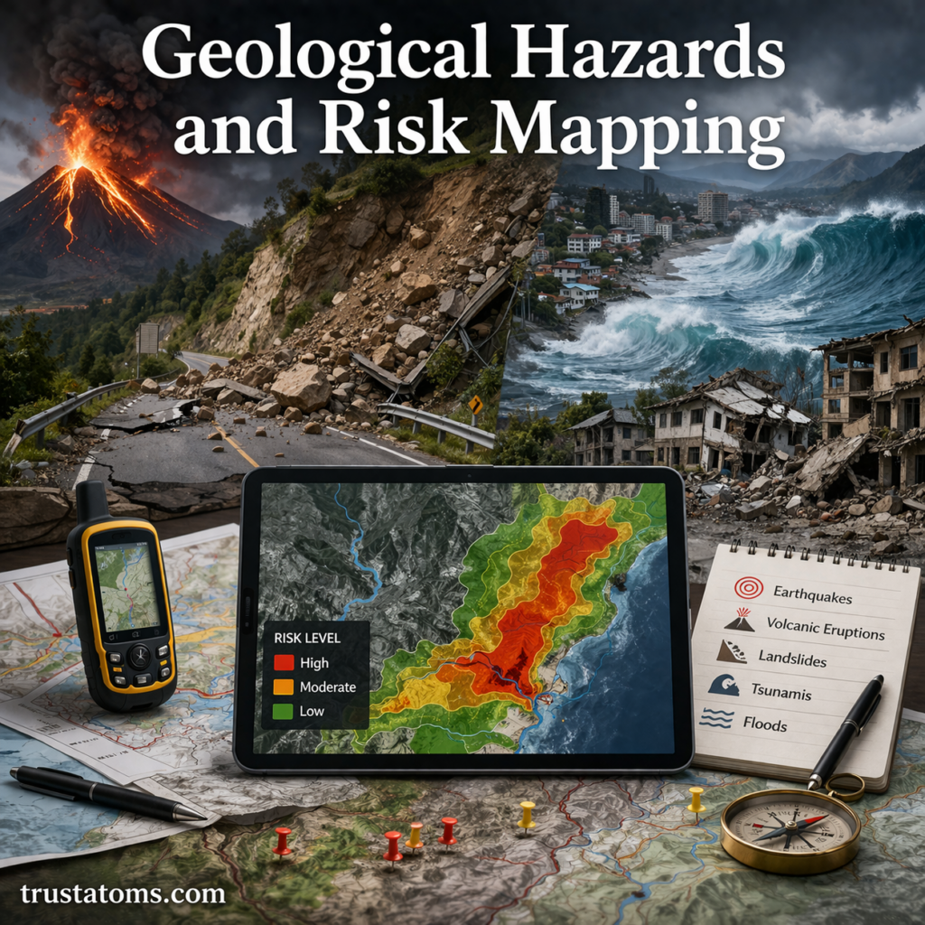
Illustration showing geological hazards like earthquakes, landslides, volcanoes, and tsunami with a digital risk map displaying danger zones.
Geological hazards include earthquakes, landslides, volcanic eruptions, and tsunamis, while risk maps show where people and infrastructure may face the greatest losses.

Geological hazards are potentially damaging natural processes, including earthquakes, volcanic eruptions, landslides, and tsunamis. Risk mapping combines information about these hazards with the locations and vulnerability of people, buildings, and infrastructure to estimate where serious losses could occur.

A powerful earthquake beneath an uninhabited region may cause limited damage, while similar shaking beneath a crowded city can have devastating consequences. Studying these differences through Earth science helps communities understand not only where hazards occur but also what makes their impacts more dangerous.

Continue reading “Geological Hazards and Risk Mapping”

Continental Crust vs Oceanic Crust

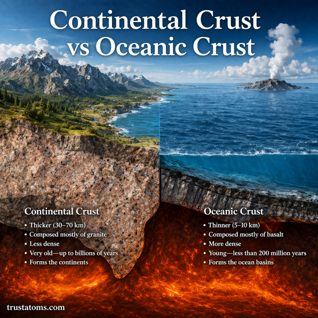
Side-by-side diagram comparing continental crust and oceanic crust showing differences in thickness, composition, and structure.
Continental crust is generally thicker, less dense, and older than the thinner, denser crust beneath most ocean basins.

Continental crust and oceanic crust are the two main types of Earth’s outermost solid layer, and they differ in thickness, density, composition, and age. Continental crust is generally thicker, less dense, and older, while oceanic crust is thinner, denser, and continually created and recycled through tectonic activity.

These differences help explain why continents stand relatively high, why deep ocean basins exist, and how mountains, earthquakes, and volcanoes develop. Comparing these crust types is part of Earth science, which examines the planet’s structure, materials, history, and changing natural processes.

Continue reading “Continental Crust vs Oceanic Crust”

Mid-Ocean Ridges and Seafloor Spreading

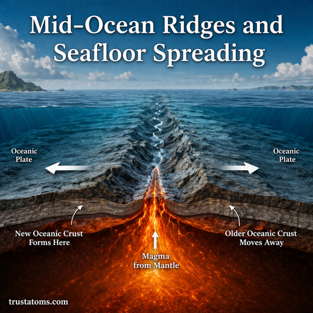
Mid-ocean ridge diagram showing seafloor spreading with magma rising and oceanic plates moving apart.
Mid-ocean ridges form where tectonic plates separate and new oceanic crust develops from cooling magma.

Mid-ocean ridges are underwater mountain chains formed where tectonic plates move apart, allowing magma to rise and create new oceanic crust. Seafloor spreading is the process by which this newly formed crust moves away from the ridge as the plates continue separating.

At these boundaries, oceanic crust is continuously created as part of the movement of tectonic plates. Studying these processes is an important part of Earth science because they explain how ocean basins develop, how the seafloor changes, and how Earth’s outer rocky shell moves.

Continue reading “Mid-Ocean Ridges and Seafloor Spreading”