Subduction Zones and Ocean Trenches

Submarine Earthquakes and Tsunami Risk — A submarine earthquake beneath the ocean and a tsunami wave approaching a coastal city
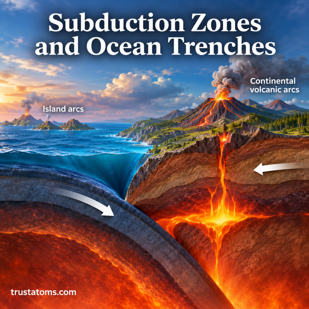
A descending oceanic plate bends beneath another tectonic plate, forming a deep trench and promoting magma generation above the sinking slab.

Subduction zones form where one tectonic plate sinks beneath another and descends into Earth’s mantle, usually at a convergent plate boundary. This downward movement creates deep ocean trenches and produces conditions associated with powerful earthquakes, volcanic chains, and the recycling of oceanic crust.

These zones are closely linked to ocean trenches, which include the deepest regions of the seafloor. Studying their formation connects plate movement, Earth’s interior, and surface landforms within the broader field of Earth science.

Continue reading “Subduction Zones and Ocean Trenches”
Tectonic Stress and Rock Deformation

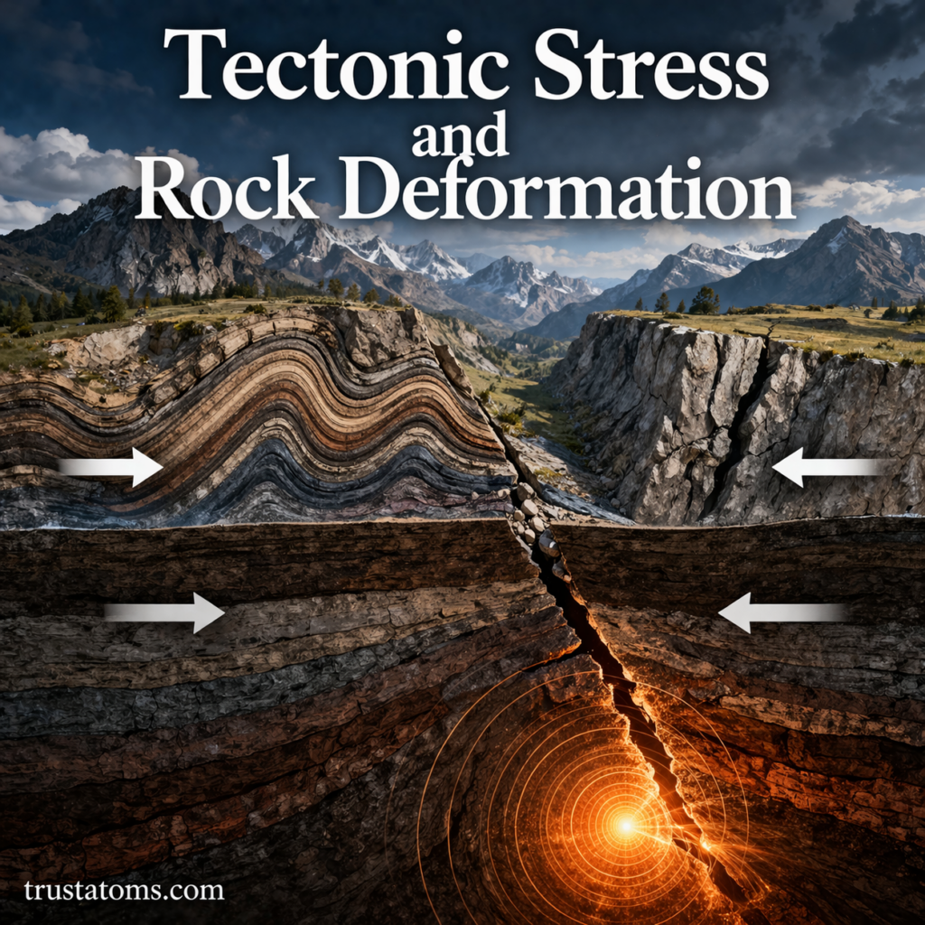
Illustration showing tectonic stress causing rock folding and faulting with arrows indicating compression and movement.
Compression, tension, and shear exert forces on crustal rocks, producing deformation that can bend layers, create fractures, or displace faults.

Tectonic stress is the force per unit area acting within Earth’s rocks, while rock deformation is the resulting change in their shape, size, or position. Forces generated by moving tectonic plates can compress, stretch, or shear rocks, producing folds, faults, mountain ranges, and earthquakes.

Rocks may deform slowly over thousands or millions of years or fracture suddenly when accumulated stress exceeds their resistance to failure. Understanding these responses is part of Earth science because geological structures preserve evidence of the forces that shaped Earth’s crust.

Continue reading “Tectonic Stress and Rock Deformation”

Weathering: Mechanical vs Chemical Processes

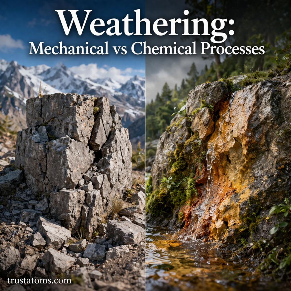
Split illustration showing mechanical weathering breaking rocks and chemical weathering altering rock with water and minerals.
Mechanical weathering physically breaks rocks apart, while chemical weathering changes their minerals through chemical reactions.

Mechanical weathering breaks rocks into smaller pieces without changing their chemical composition, while chemical weathering changes or dissolves minerals through chemical reactions. Both processes act at or near Earth’s surface, often working together to weaken rock, produce sediment, and help form soil.

Weathering is a fundamental process studied in Earth science because it helps explain how exposed rock gradually changes. Water, temperature fluctuations, oxygen, and living organisms can all contribute, but the way they affect rock depends on whether physical forces or chemical reactions are involved.

Over time, it shapes landscapes, forms soil, and influences ecosystems. Unlike erosion, which moves material, weathering works in place—gradually weakening and altering rock. The distinction helps explain why a rock can crack, dissolve, or develop a rusty surface before its fragments are carried away.

Continue reading “Weathering: Mechanical vs Chemical Processes”

Earth’s Gravity Variations

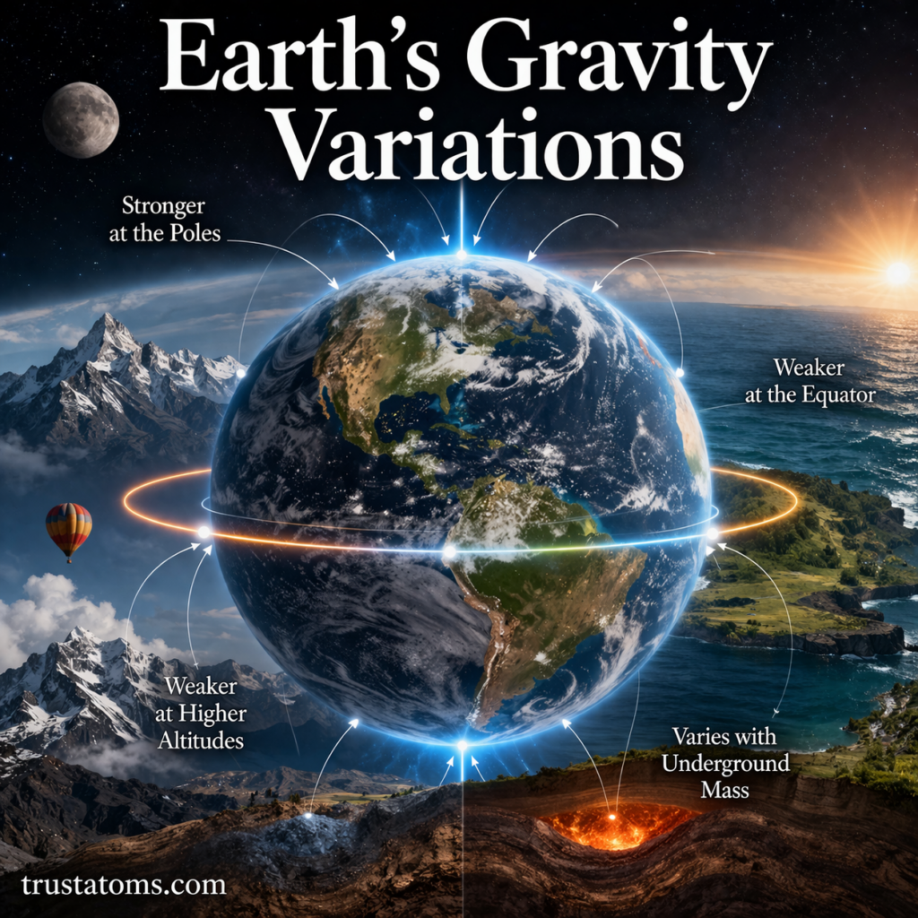
Illustration showing Earth’s gravity variations with stronger gravity at the poles and weaker at the equator and higher altitudes.
Gravity is generally stronger near Earth’s poles and weaker near the equator and at higher elevations because of the planet’s shape, rotation, and mass distribution.

Earth’s gravity varies slightly from place to place because the planet is not a perfect sphere, it rotates, and its mass is distributed unevenly. Gravity is generally stronger near the poles, weaker near the equator, and slightly reduced at higher elevations, while underground density differences create additional local variations.

Although these differences are too small for most people to notice, scientists can measure them with highly sensitive instruments. Studying gravity variations is an important part of Earth science because the measurements reveal information about Earth’s interior, changing ice sheets, and ocean circulation.

Gravity measurements also help distinguish the effects of Earth’s overall shape from smaller changes caused by mountains, buried rock formations, and movements of water.

Continue reading “Earth’s Gravity Variations”

Volcanic Landforms and Lava Types

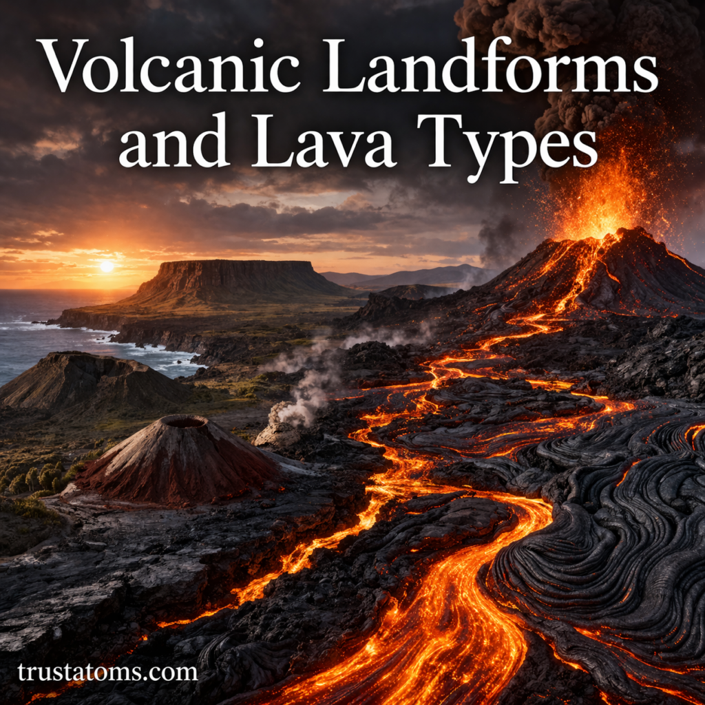
Illustration of volcanic landforms with flowing lava, erupting volcano, and different terrain formations.
Volcanic eruptions build mountains, lava fields, and other landforms as molten rock and fragmented material accumulate at Earth’s surface.

Volcanic landforms are features such as shield volcanoes, composite volcanoes, lava domes, and lava plateaus created by eruptions and the accumulation of volcanic material. Their shapes depend on lava composition, viscosity, eruption style, and how molten rock and volcanic fragments spread across the landscape.

Fluid lava can build broad, gently sloping volcanoes, while thicker lava often accumulates near vents or contributes to steeper formations. Understanding these relationships is part of Earth science, which examines the processes that continually reshape Earth’s surface.

Continue reading “Volcanic Landforms and Lava Types”

Earth’s Formation in the Early Solar System

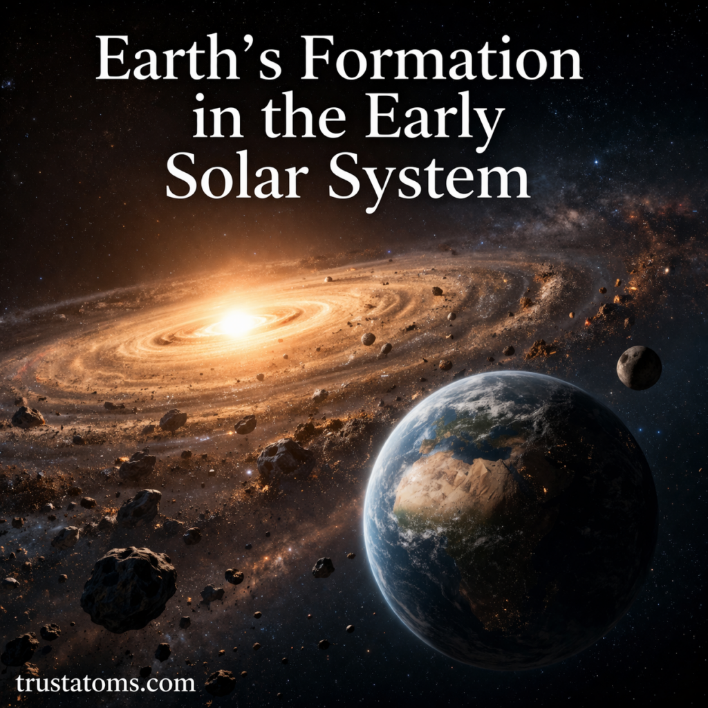
Illustration of Earth forming in the early solar system with a protoplanetary disk and surrounding space debris.
According to the solar nebula model, Earth formed as rocky material accumulated within a rotating disk of gas and dust surrounding the young Sun.

According to the scientific model of solar system formation, Earth developed approximately 4.54 billion years ago as dust, rock, and larger bodies accumulated around the young Sun. Gravity, collisions, internal heating, and the separation of dense and lighter materials gradually produced a layered planet with a solid surface, atmosphere, and eventually oceans.

Scientists reconstruct this history using meteorites, ancient minerals, planetary observations, and physical models. These investigations connect astronomy with Earth science, revealing how the same natural processes that shaped other planets also influenced Earth’s early development.

Earth did not form in a single event. Its development involved repeated collisions, episodes of extensive melting, and gradual changes in its surface and atmosphere, with some details still being investigated.

Continue reading “Earth’s Formation in the Early Solar System”

Geothermal Energy and Heat Flow

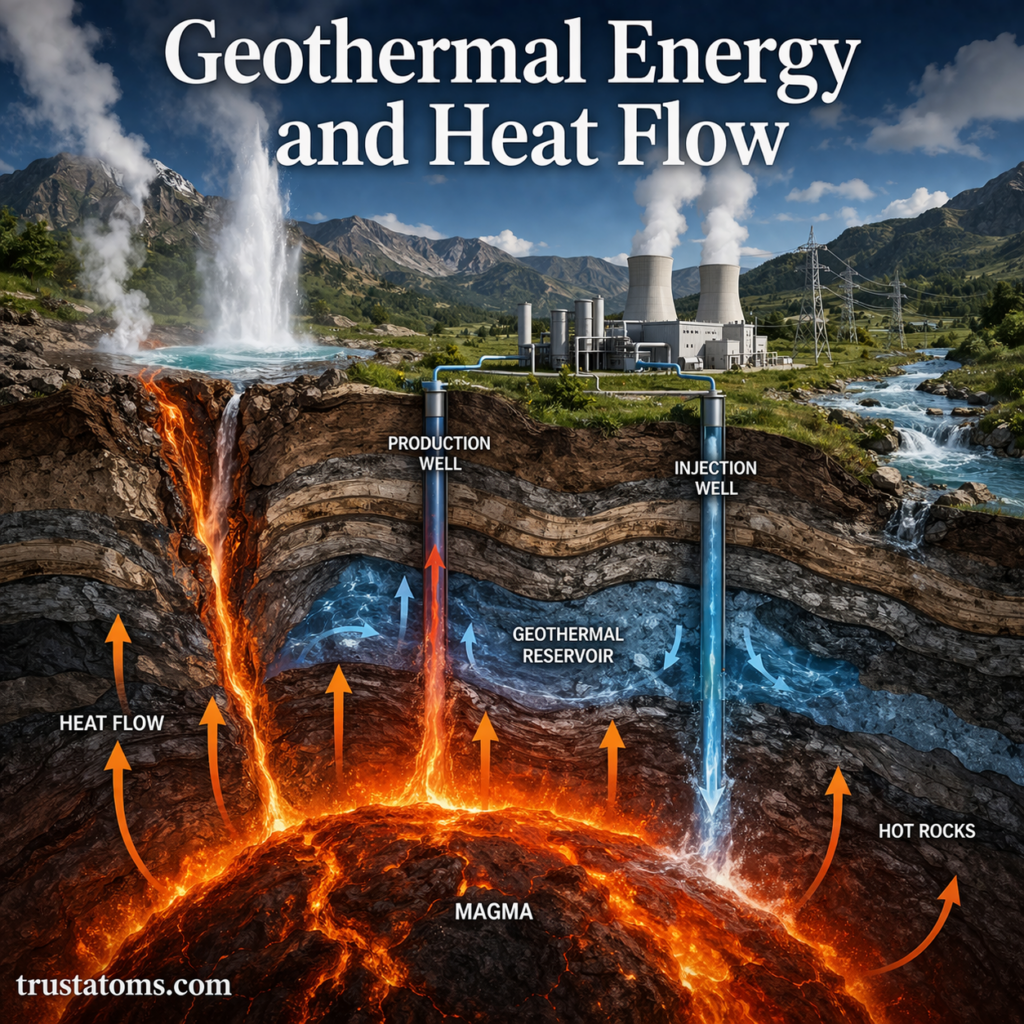
Illustration of geothermal energy and heat flow showing magma, geothermal reservoir, wells, and underground heat movement.
Geothermal systems capture underground heat through hot rock, water reservoirs, and wells that bring thermal energy toward the surface.

Geothermal energy is heat stored inside Earth that can be used to generate electricity, heat buildings, and support industrial processes. Heat flow is the transfer of thermal energy from Earth’s hotter interior toward its cooler surface, driven by temperature differences and geological activity.

Unlike solar or wind energy, geothermal energy originates beneath the ground and can provide a steady source of heat regardless of weather conditions. Studying this energy is part of Earth science, which examines how the planet’s interior, surface, and interacting systems operate.

Continue reading “Geothermal Energy and Heat Flow”

Groundwater in Geological Systems

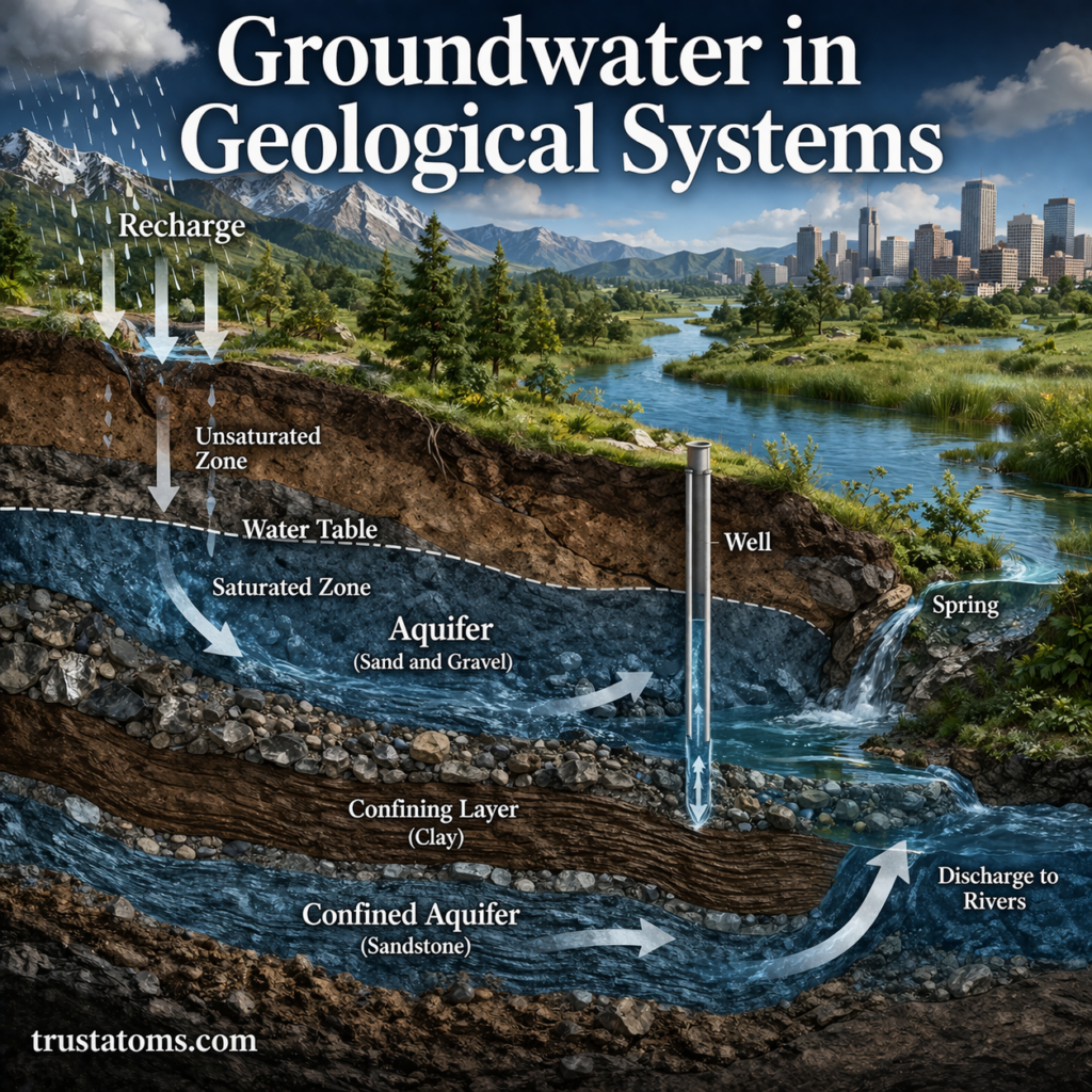
Illustration of groundwater in geological systems showing aquifers, water table, recharge, discharge, and underground water flow.
Groundwater moves through connected pores and fractures in geological layers, with recharge replenishing aquifers and discharge supplying surface waters.

Groundwater is water stored beneath Earth’s surface in the tiny spaces between soil and sediment particles and in cracks within rocks. It moves through these underground materials, supplying wells, springs, rivers, and ecosystems. Unlike an underground lake, most groundwater is distributed throughout the pores and fractures of geological formations.

Groundwater is one of Earth’s most important hidden resources. It supplies drinking water, supports agriculture, and helps maintain streams during dry periods. Understanding how rocks store and transmit water is part of Earth science, which examines the interactions among Earth’s land, water, atmosphere, and living systems.

The availability of groundwater depends on rainfall, rock properties, underground pressure, and how quickly water is withdrawn. These factors explain why some wells provide abundant water while others produce very little, even when drilled to similar depths.

Continue reading “Groundwater in Geological Systems”

Mineral Resources and Geological Distribution

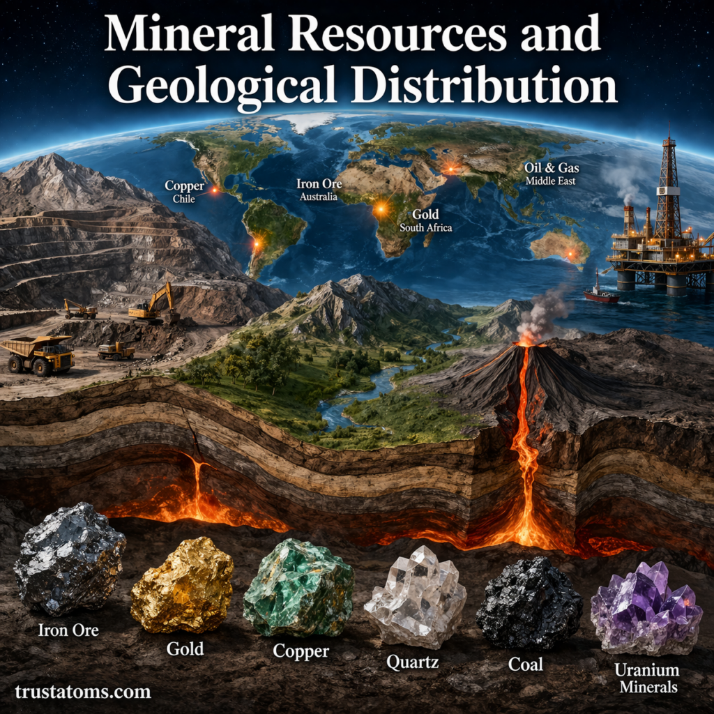
Illustration showing global mineral resources and geological distribution with mining, volcanoes, and key resource locations.
Geological processes concentrate valuable mineral resources in different regions of Earth’s crust.

Mineral resources are naturally occurring geological materials that contain useful substances in concentrations with potential economic value. Their distribution across Earth is uneven because processes such as magma cooling, hydrothermal circulation, sedimentation, and metamorphism concentrate different materials in particular geological settings.

These resources supply metals for electronics, minerals for fertilizers, and raw materials for construction and manufacturing. Understanding where they occur is part of Earth science, which examines the processes that shape Earth’s materials and landscapes.

Continue reading “Mineral Resources and Geological Distribution”

Earthquakes and Fault Systems

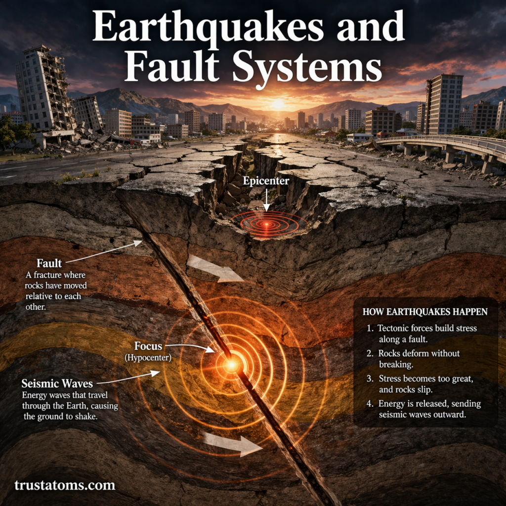
Illustration of earthquakes and fault systems showing fault line movement, epicenter, focus, and seismic waves.
An earthquake begins when rocks suddenly slip along a fault, releasing seismic waves from the focus beneath Earth’s surface.

Earthquakes occur when accumulated stress causes rocks to slip suddenly along faults, releasing energy as seismic waves that shake the ground. Fault systems are networks of related fractures that accommodate movement in Earth’s crust and influence where earthquakes begin, how ruptures spread, and which areas face seismic hazards.

Earthquakes are among the most powerful natural events on Earth. They occur when built-up energy in the crust is suddenly released, sending seismic waves through the ground. Studying these processes is an essential part of Earth science because they reveal how tectonic forces reshape the planet.

Not all faults behave alike. Some allow rocks to slide sideways, others produce vertical displacement, and many remain locked for long periods before moving abruptly.

Continue reading “Earthquakes and Fault Systems”