Flooding is one of the most common and costly natural hazards worldwide. As populations grow and development expands into vulnerable areas, understanding flood risk becomes increasingly important.
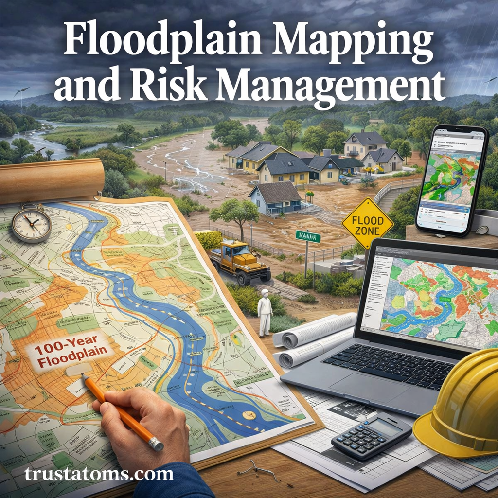
Floodplain mapping and risk management are essential tools used by scientists, planners, and communities to predict flooding, guide development, and protect lives and property.
What Is a Floodplain?
A floodplain is a flat or low-lying area adjacent to rivers, streams, or coastlines that is prone to flooding.
Key Characteristics of Floodplains
- Periodically flooded during heavy rain or storms
- Rich in sediments and nutrients
- Often used for agriculture or development
- Dynamic and constantly changing over time
Floodplains are naturally part of a river system, but human activity often increases the risk associated with them.
Types of Floodplains
Understanding different floodplain types helps clarify how risk varies by location.
1. Riverine Floodplains
- Found along rivers and streams
- Flood during prolonged rainfall or snowmelt
- Most common type
2. Coastal Floodplains
- Located near oceans or large bodies of water
- Affected by storm surges, hurricanes, and sea-level rise
3. Flash Flood Zones
- Occur in areas with rapid water accumulation
- Common in urban areas or steep terrain
- Little to no warning time
What Is Floodplain Mapping?
Floodplain mapping is the process of identifying areas at risk of flooding using scientific data and modeling.
How Floodplain Maps Are Created
Floodplain maps are developed using a combination of:
- Historical flood data
- Rainfall and climate patterns
- Topographic elevation data
- River flow and hydraulic models
- Satellite imagery and geographic information systems (GIS)
These maps help visualize which areas are most likely to flood under specific conditions.
Understanding Flood Zones
Flood maps typically divide areas into zones based on risk levels.
Common Flood Zone Classifications
- High-risk zones (often called 100-year flood zones)
- Moderate-risk zones
- Low-risk zones
What Does “100-Year Flood” Mean?
A 100-year flood does not mean it happens once every 100 years. It means there is a 1% chance of flooding in any given year.
This distinction is critical for understanding real risk.
Why Floodplain Mapping Matters
Floodplain mapping plays a central role in disaster preparedness and land-use planning.
Key Benefits
- Identifies high-risk areas before development
- Supports emergency planning and evacuation routes
- Helps determine flood insurance requirements
- Guides infrastructure design and zoning laws
- Reduces long-term economic losses
Without accurate mapping, communities are more vulnerable to unexpected flooding.
Flood Risk Factors
Flood risk is influenced by both natural and human-made factors.
Natural Factors
- Heavy rainfall and storms
- Snowmelt
- Soil saturation
- River capacity
- Coastal tides and storm surges
Human Factors
- Urbanization and impervious surfaces
- Deforestation
- Poor drainage systems
- Development in flood-prone areas
- Climate change
Managing these factors is key to reducing overall risk.
Flood Risk Management Strategies
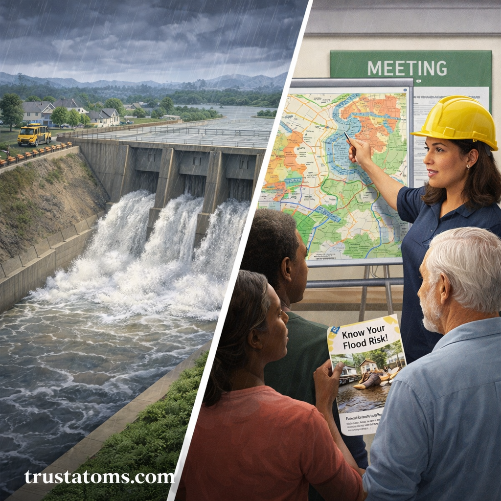
Effective flood risk management combines planning, engineering, and community awareness.
Structural Approaches
These involve physical systems designed to control water flow.
- Levees and floodwalls
- Dams and reservoirs
- Stormwater drainage systems
- Retention and detention basins
Non-Structural Approaches
These focus on policies and behavior rather than physical barriers.
- Zoning regulations
- Floodplain preservation
- Early warning systems
- Public education programs
- Flood insurance programs
Both approaches are necessary for comprehensive risk reduction.
Role of Technology in Floodplain Mapping
Modern technology has significantly improved flood prediction and mapping accuracy.
Key Technologies Used
- Geographic Information Systems (GIS)
- Remote sensing and satellite imagery
- LiDAR (Light Detection and Ranging)
- Hydrologic and hydraulic modeling software
These tools allow scientists to simulate flood scenarios and update maps more frequently.
Community Planning and Flood Resilience
Communities play a critical role in managing flood risk.
Smart Planning Practices
- Avoid building in high-risk flood zones
- Elevate structures above flood levels
- Preserve wetlands and natural buffers
- Design flood-resistant infrastructure
- Develop evacuation and response plans
Long-term resilience depends on proactive planning rather than reactive recovery.
Common Mistakes to Avoid
- Ignoring floodplain maps when buying property
- Underestimating flood risk outside high-risk zones
- Failing to maintain drainage systems
- Over-relying on structural defenses alone
- Not updating maps with new data
Avoiding these mistakes can prevent costly and dangerous outcomes.
Future Trends in Flood Risk Management
As climate patterns change, flood risks are evolving.
Emerging Trends
- Increased use of real-time flood monitoring
- Climate-adaptive infrastructure design
- Nature-based solutions like wetland restoration
- Improved data sharing and modeling accuracy
- Integration of AI in risk prediction
Communities that adapt early will be better prepared for future challenges.
Final Thoughts
Floodplain mapping and risk management are essential for reducing the impact of flooding on people, property, and ecosystems. By understanding flood zones, using modern mapping tools, and implementing smart planning strategies, communities can significantly lower their vulnerability.
Preparedness begins with knowledge—and floodplain maps are one of the most powerful tools available to guide safer decisions.